Possible Shift in the Indian Ocean Dipole?
02/26/2024, 5:59 am ESTSmokehouse Creek Fires Receive Synoptic Scale High Wind
02/29/2024, 12:53 pm ESTChart of the day: IOD pattern is flipping toward negative phase.
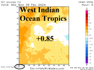
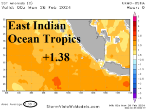
Discussion: The tropical Indian Ocean SSTA have shifted very warm. The 2023 +IOD pattern has ended. Although West Indian Ocean SSTA is still quite warm (+0.85C), the east-southeast tropics are now extremely warm (+1.38C). Indicated is a weak -IOD signature which may help to explain the unexpected wet bias to Australia climate, give the El Nino pattern.
Week-2 Ahead Forecast valid March 3-9, 2024: Using cooler AI model.
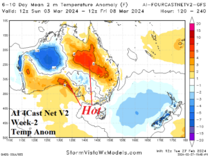
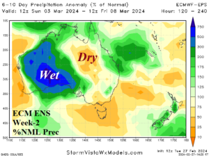
Discussion: Using the AI 4Cast Net V2 model which indicates suppressed heat risk for Western Australia due to a wet forecast. Tropical rains are featured but not from a tropical cyclone.
Week-3 Ahead Forecast valid March 10-16, 2024: Western Australia thundershowers.
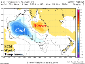
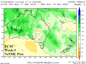
Discussion: Upper trough over Western Australia brings rain suppressing temperatures. Queensland remains the hot spot.
Week-4 Ahead Forecast valid March 17-23, 2024: More tropical thundershowers Western Australia.
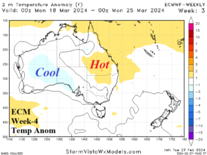
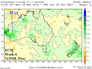
Discussion: Patchy thundershowers remain across Western Australia continuing to suppress late summer anomalous heat risk.