Two Tropical Cyclones Ahead In Central North Atlantic Tropics
06/19/2023, 3:58 pm EDTEl Nino Is Strengthening
06/27/2023, 10:36 am EDT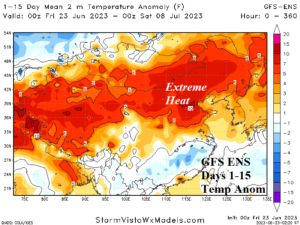
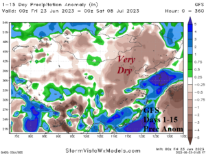
Fig. 1-2: The GFS ENS 15-day temperature anomaly forecast and GFS precipitation anomaly forecast across China.
Discussion: In the latest example of the influence of a rapidly emerging marine heat wave (MHW) has on warming the atmosphere aloft to propel high pressure ridging and weather patterns featuring sudden extreme heat and dryness, the “highest alert possible” for heat in Beijing, China is issued. The GFS indicates a long duration heat wave across North and Northeast China including north/west wheat and soybean areas (Fig. 1). The anomalous heat is accompanied by little or no rain in the GFS 15-day rainfall outlook (Fig. 2). An emerging MHW in the Sea of Japan, Yellow Sea, and East China Sea (Fig. 3) has developed rapidly during the past 30 days (Fig. 4). The 16-day MAX/MIN forecast for Beijing features consistent 100-110F daytime risk (Fig. 5).
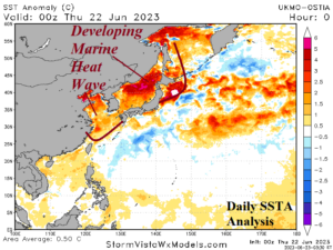
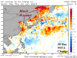
Fig. 3-4: West Pacific SSTA analysis and the 30-day change.
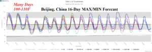
Fig. 5: The latest 16-day MAX/MIN forecast for Beijing, China.