Stratospheric Warming Appears in 15 Days
11/21/2023, 9:51 am ESTPotential Complete Reversal in ENSO Phase by July/August 2024
11/27/2023, 2:46 pm EST 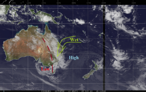
Fig. 1: Current weather satellite view across Australia highlighting more Eastern Australia rains.
Discussion: Satellite view reveals a persistent low-pressure trough extending northward from low pressure off the Southeast Australia Coast maintains wet weather in East Australia with hefty amount continuing (Fig. 1). The latest 10-day outlook by GFS stays very wet in the East (Fig. 2). There are some signs that the unexpected wet weather regime may ease after 10 days.
In Europe, a cold pattern has evolved. North Atlantic oscillation (NAO) becomes negative and is maintained through the next 2 weeks. The 15-day temperature anomaly outlook is trending colder, and an expanding snow cover certainly helps that regime (Fig. 3-4).
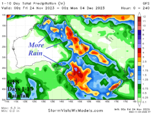
Fig. 2: The GFS 10-day rainfall amount forecast.
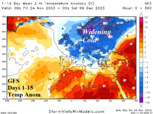
Fig. 3: The GFS 15-day temperature anomaly forecast across Europe.

Fig. 4: The GFS snow cover projection for 15 days from now.