Europe/Western Russia Winter 2023-24 Forecast Verification
03/13/2024, 5:15 pm EDTNorth-central U.S. Blizzard Early Next Week Biases U.S. Medium-range Forecasts Cooler
03/22/2024, 8:35 am EDT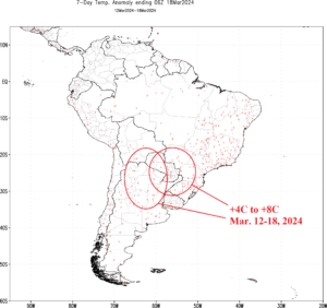
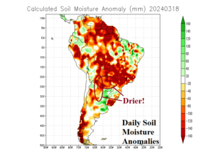
Fig. 1-2: The Mar. 12-18, 2024 South America temperature anomaly observations and daily soil moisture anomalies.
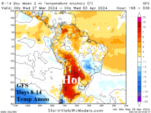
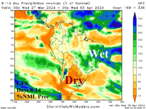
Fig. 3-4: The GFS 8-14-day temperature anomaly and percent of normal precipitation forecast for South America.
Discussion: During the past week, extreme heat has attacked Northern Argentina to Southwest Brazil where weekly temperature anomalies are in the +4C to +8C range (Fig. 1). As a result, sudden drying of soils has developed and accelerated in Northern Argentina, Paraguay, and Southwest Brazil (Fig. 2). More anomalous heat and dryness is ahead for Argentina especially in the 8-14-day period according to GFS (Fig. 3-4). As Argentina becomes drier, the wet weather shifts to Brazil.
In the U.S., a wintery scenario is indicated for the North-central U.S. and Upper Midwest States likely stretching to parts of the U.S. Corn Belt as snowstorm risk is presented. The first in a series of snow events develops tomorrow across the Dakotas to Wisconsin (Fig. 5). A second widespread event affecting the entire North-central and Midwest U.S. emerges this weekend peaking in intensity Sunday when blizzard conditions are possible (Fig. 6).
The snow cover forces cold weather and southern extent of <32F into the southern Great Plains at times through the next 10 days (Fig. 7-8). Areas with snow cover dip to the upper teens/low 20’s at night during this cold period.
Heavy rain risk redevelops for Western Europe next week (Fig. 9) and is maintained across north and northeast Australia as the remnants of former Tropical Cyclone Megan weakens very slowly (Fig. 10).
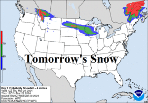
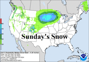
Fig. 5-6: NOAA/WPC snowfall probability forecast for tomorrow and Sunday.
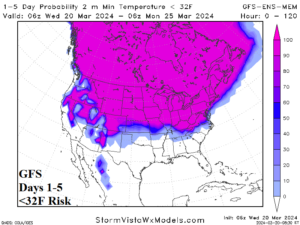
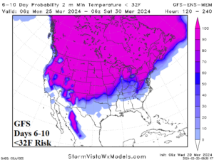
Fig. 7-8: GFS 10-day <32F forecast in the U.S.
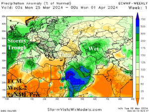
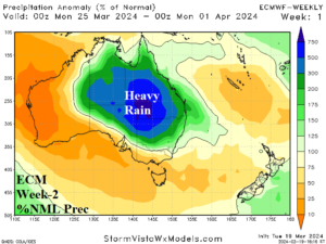
Fig. 9-10: ECM week-2 (next week) percent of normal rainfall forecast across Europe/Western Russia and Australia.