U.S. Gas Population Weight HDD Forecasts Chill to Near Normal
10/20/2023, 9:18 am EDTSubsurface Equatorial Pacific Warmth to Sustain El Nino Strengthening Near Dateline
10/24/2023, 8:24 am EDT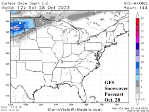
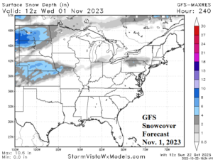
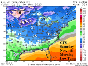
Fig. 1-3: The 12Z GFS snow cover projection for early next weekend and Nov. 1st (top) with coldest morning of the next 15 days projected by GFS for Nov. 4, 2023.
Discussion: Weekend forecasts are trending colder in the U.S. thanks to developing Great Plains snow cover and stratospheric warming in the extended range across eastern North America. Upslope flow generates very cold air into the Northern Continental Divide during the next few days. The cold air spreads eastward as attendant snow cover also expands to the Dakotas this week (Fig. 1) with additional snow possible next week through the central Great Plains (Fig. 2). Potentially, the coldest morning is Nov. 4th when below zero strikes the northern Great Plains with 20’s to the Tennessee Valley and Northeast States (Fig. 3).
In Europe, the wet forecasts from late last week trend wetter. A vigorous upper trough west of Europe expands into Europe and is semi-permanent into early November causing widespread 2-5 in. of rain (Fig. 4). In Australia, patchy wet weather events are forecast on the east/southeast coastlines through the next 15 days (Fig. 5).
Heavy rains streak across Northeast Argentina and Southeast Brazil this week (Fig. 6) extending northward to much of Eastern Brazil next week (Fig. 7). Forecast models are hotter than normal for much of Brazil throughout the next 2 weeks. The Central Brazil pattern is drier and hotter than normal where drought development is expected over the next 1-3 months.
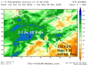

Fig. 4-5: The 12Z GFS 15-day percent of normal rainfall across Europe and Australia.
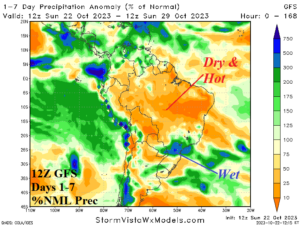
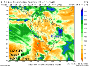
Fig. 6-7: The 12Z GFS percent of normal rainfall forecast through the next 2 weeks across South America.
