10/29/2025, 6:01 am EDT
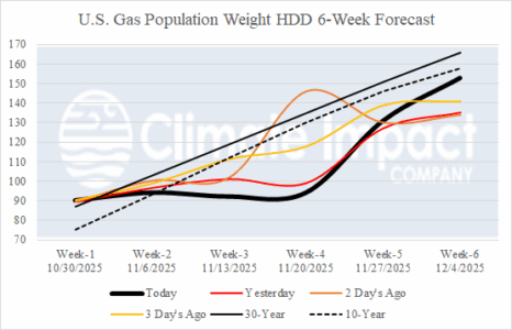
The U.S. gas population weight HDD forecast trend is warmer for the first 2/3 of November likely to stay that way through early meteorological winter. In the U.S., the cold risk is during mid-to-late winter. Western Europe HDDs are generally warmer than normal for upcoming winter and not as cold as the past 2 winter seasons during January.

