04/13/2026, 12:03 pm EDT
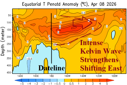
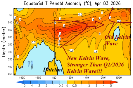
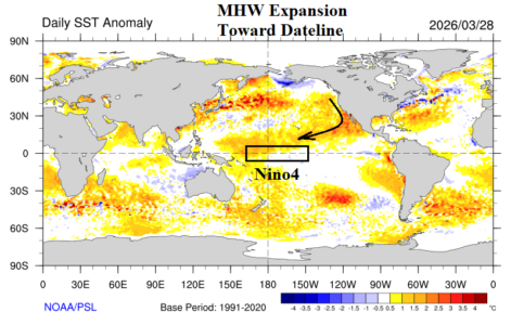
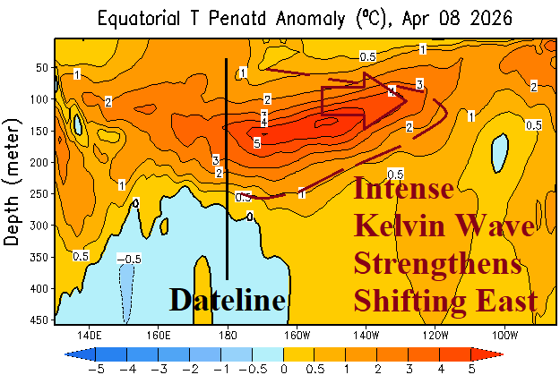
Neutral ENSO continues during early April as the Nino34 SSTA is unchanged at +0.2C. Last week, some warming was observed off the northwest coast of South America (Nino12). The subsurface upper ocean heat is MUCH warmer than normal and intensifying. The NEW Kelvin Wave features ocean temperatures 6-7C warmer than normal extending to just east of 150W and further eastward shifting is likely.