01/21/2026, 1:00 pm EST
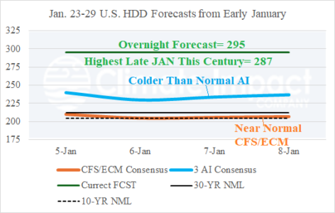
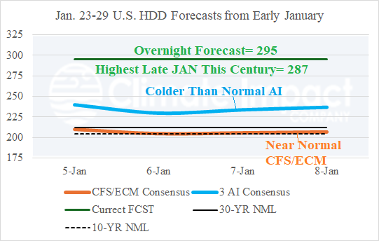
The U.S. HDD outlook in today’s week-4 outlook is colder than normal utilizing a consensus between AI 4CastNet V2 ECM ENS, AI 4CastNet V2 GFS ENS, and AI Graph Cast ECM ENS. The CFS V2/ECM consensus is warmer. Of interest is the record strength 295 HDD forecast for the last week of January from overnight compared to week-4 forecasts made earlier this month. AI was much colder than the CFS V2/ECM consensus.

