06/22/2025, 9:40 am EDT
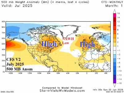
Formation of the North Atlantic warm hole (NAWH), the strongest since 2018 fuels an upper air pattern promoting hot and potentially dry high pressure ridge areas across the East U.S. and much of Europe for mid-summer. Dangerously hot weather is developing and the risk of continuation during July has increased significantly.

