07/07/2025, 4:58 am EDT
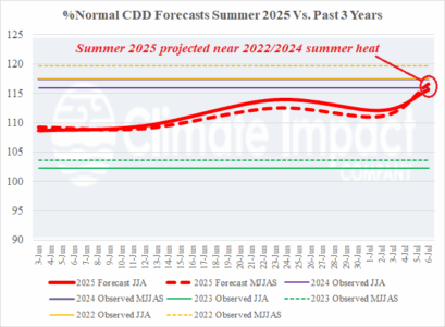
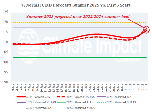
The Climate Impact Company U.S. selected cities CDD forecast shifted hotter in this week’s update and is close to the 2022 and 2024 observations. Summer of 2022 ranked 3rd hottest on record for the U.S. while summer 2024 ranked 4th hottest. The observed summer 2025 CDD will rival the 2022 and 2024 heat primarily due to the anomalous heat observed in the PJM sector.

