02/16/2026, 11:52 am EST
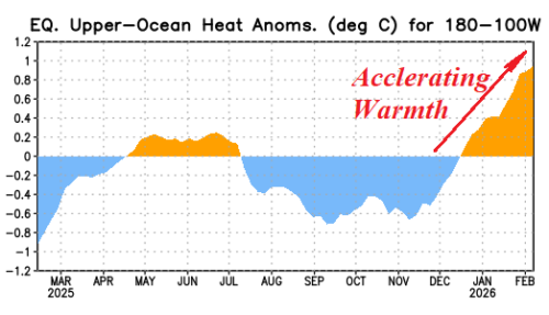
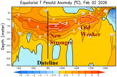
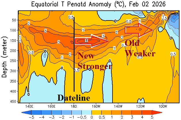
The subsurface eastern equatorial Pacific continues too steadily warm. A Kelvin Wave moving east across the Dateline during early December reached waters off northwest South America recently while a second Kelvin Wave emerged near and east of the Dateline and is drifting eastward. The atmosphere remains slow to respond as southern oscillation index (SOI) stays positive and 15-day forecasts maintain the positive phase.