08/04/2025, 8:16 am EDT
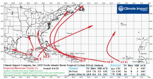
The FINAL Climate Impact Company 2025 North Atlantic basin seasonal tropical cyclone forecast indicates (after Tropical Storm Dexter) that an additional 12 tropical cyclones will form of which 7 become hurricanes and 4 reach major hurricane strength. The accumulated cyclone energy (ACE) index forecast is 135.