12/31/2025, 9:58 am EST

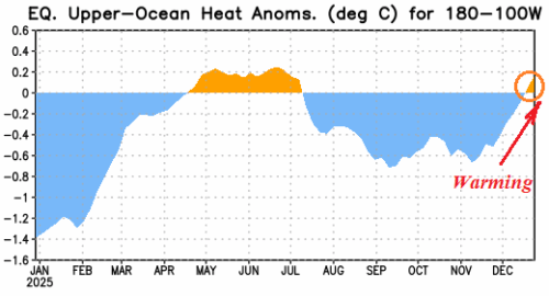
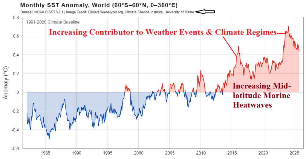
Globally, 2025 projects as the third warmest on record (DEC-25 data not yet available as of this writing). As of December 1st, the U.S. has observed the fifth warmest year in the 131-year period of record. A significant contributor to the warmer climate is the influence of increasing ocean temperature, most notable in the middle latitudes accelerated by the presence of marine heatwaves (MHW).