07/28/2025, 12:14 pm EDT
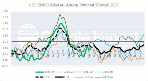
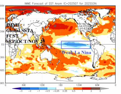
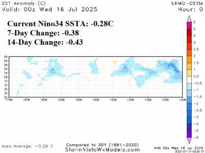
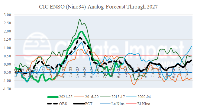
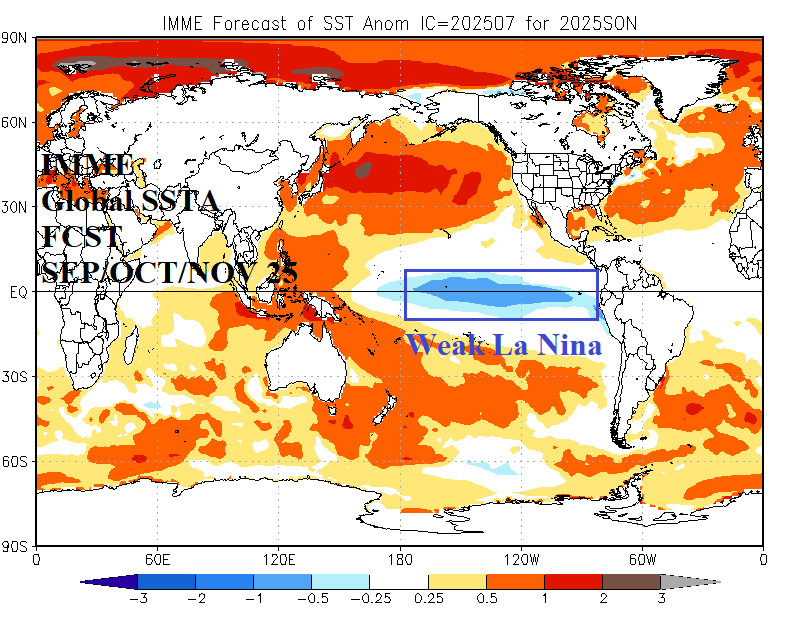
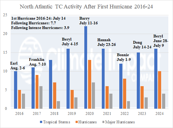
To help generate new season 1-4 ahead global climate forecasts, a constructed analog projection (through 2027) for ENSO, PDO, AMO, and IOD is revealed. The ENSO outlook indicates weak La Nina potential for Q4/2025 coupled with -IOD which supports wet Australia climate. The tendency of ENSO toward weak La Nina increases risk of significant tropical cyclone activity in the North Atlantic basin during AUG/SEP/OCT. The longest -PDO on record will continue possibly changing character to cooler Northeast Pacific SSTA (which promotes La Nina). The AMO regime stays warm through 2027.
