02/05/2026, 4:06 pm EST

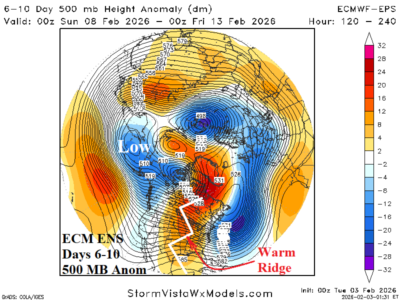
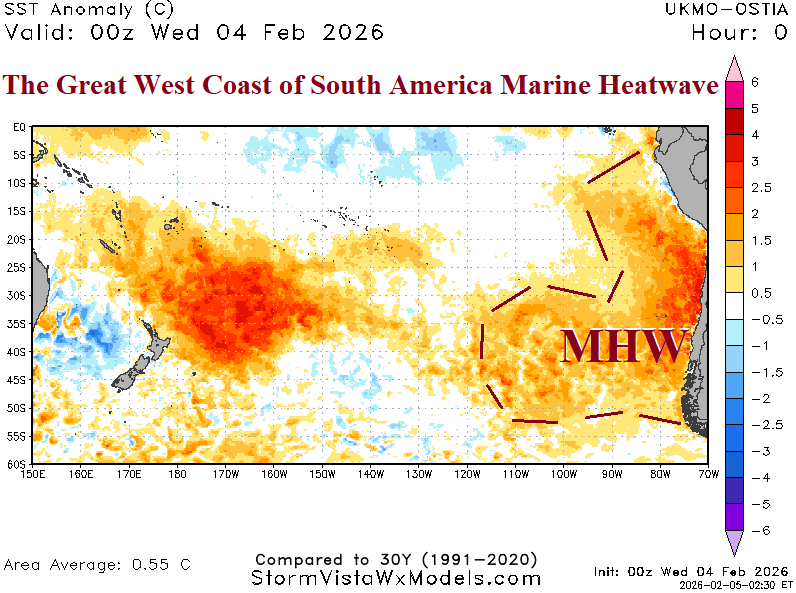
The warmest sea surface temperature anomalies (SSTA) on record for early February stretching north-to-south off the coast of Chile and Peru exceeding 3C throughout much of this region has generated. Onset of this large and intense marine heatwave (MHW) occurred in DEC-25. Strengthening continues especially along the immediate coast of Chile during the past 2 weeks. The warming is spreading equatorward. The daily Nino12 SSTA region off the northwest coast of South America is +0.63C today and 1.27C warmer than 30 days ago.