03/09/2026, 5:27 am EDT
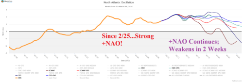
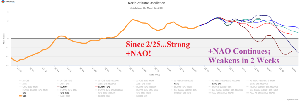
Vigorous positive phase of the North Atlantic oscillation is the lead climate signal supporting the warm pattern across the U.S. during the past 14 days. The negative phase of the Pacific North America (-PNA) has dominated in recent weeks although under-performing as a wet/snowy weather maker in the Northwest/West U.S. while the attendant dry signal for the Southeast is strong.
