05/20/2026, 4:00 pm EDT

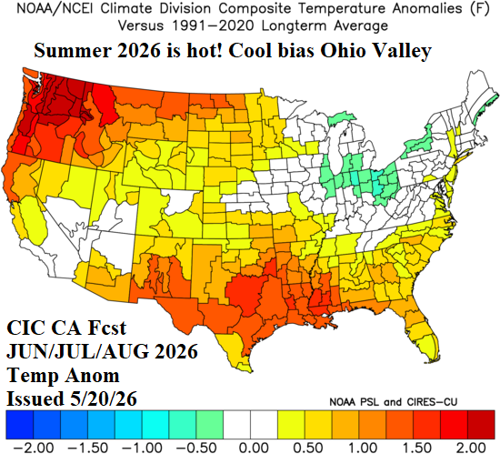
Climate Impact Company Updates The U.S. Summer 2026 Outlook

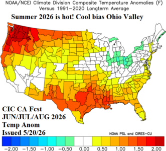
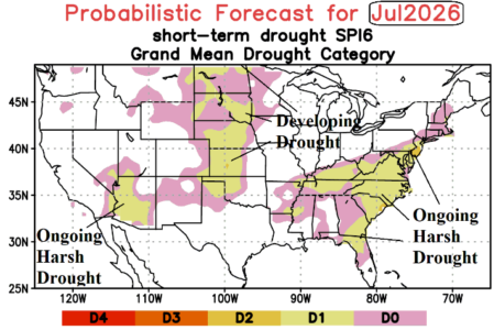
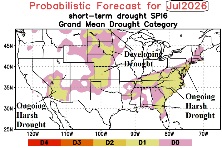
The outlook is based on historical regional SSTA patterns including vigorous development of El Nino and ongoing soil moisture conditions similar with expectations for middle 2026 and the correlating upper air pattern generating sensible weather. The outlook is consistent with 5/4 forecast emphasizing anomalous heat in the Northwest and Gulf States, with dryness enhancing heat in the Gulf region, Northwest U.S., and Upper Midwest.
05/19/2026, 10:06 am EDT

U.S. Daily Energy Report: Leading indicators are -PNA and emerging MJO.

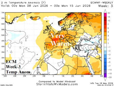
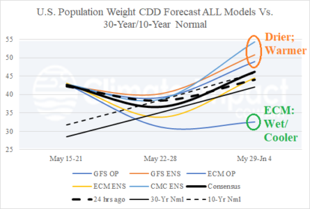
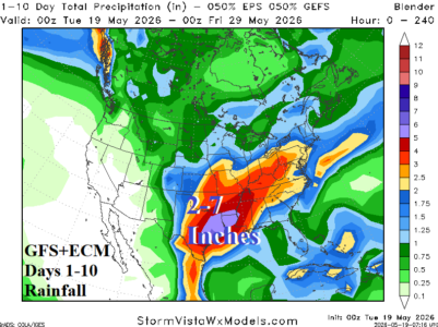
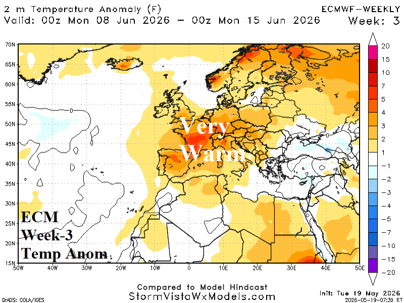
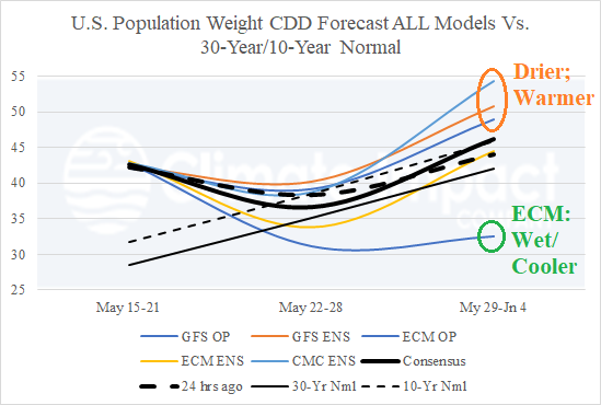
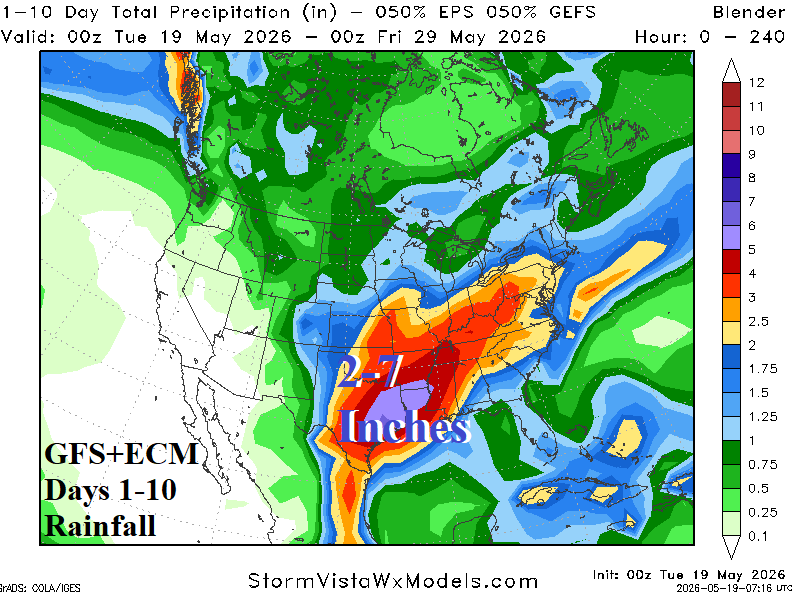
This week’s heat spike in the East and Southeast weighs heavily on national electricity demand. The national CDD count lowers to near normal next week. The ECM forecast is wetter and suppresses heat risk into early June while other models are less wet allowing some rewarming in the East. In the extended range, 2 of 3 AI models shift much warmer for the week ending June 15th while CFS shifts cooler to near normal.
05/17/2026, 10:07 am EDT

Focus on U.S. Soil Moisture/Rainfall Forecasts and ENSO Update

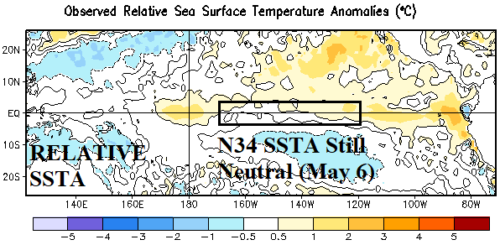
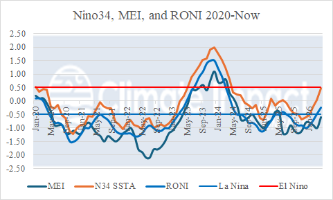
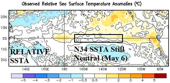
The NEW relative SSTA analysis across the Pacific basin reveals neutral ENSO as measured within the Nino34 SSTA region. Conversely, the standard global SSTA analysis reveals moderate El Nino has formed. As of late April, multivariate ENSO index was -0.6, indicating a lingering La Nina climate.
05/15/2026, 9:24 am EDT

So Far in May, Midwest U.S. Soils are Drier. Wet Weather to Return!

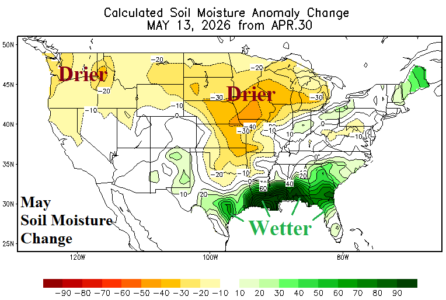
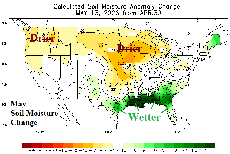
The U.S. Weekly Drought Monitor analysis reveals a slight increase (76%) from the previous week in aerial coverage of dry-to-drought soil moisture conditions while severe (D3-D4) drought remains unchanged at 19%. During May so far, U.S. soil moisture tendency is much drier across the Midwest States and much wetter in the Gulf region. Wet weather including daily severe weather events regenerates in the Central U.S. through the weekend into early next week!
05/15/2026, 9:19 am EDT

ECM/CFS Warm June (CDD’s); AI Shifts Cooler

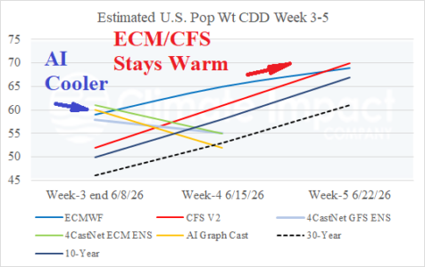
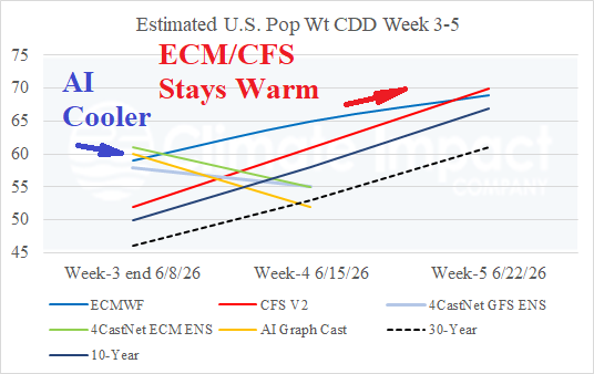
The estimated U.S. population weight CDD forecast indicates dynamic models ECM and CFS stay warmer than normal in the week 3-5 outlook while AI models are warmer than ECM/CFS in early June and much cooler for mid-June.
05/14/2026, 4:58 am EDT

The Springtime ENSO Prediction Barrier LINGERS!

We are experiencing elements of the ENSO springtime predictability barrier, specifically, lack of a sustained atmosphere-to-ocean link to force an El Nino climate. The equatorial oceanic warming is there but the atmospheric reflection lags.
05/13/2026, 3:58 pm EDT

Cool Season Precipitation Pattern Across South America During Super El Nino

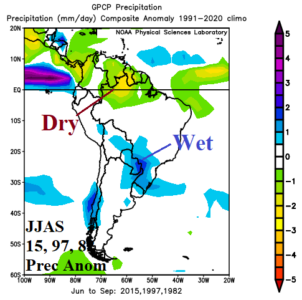
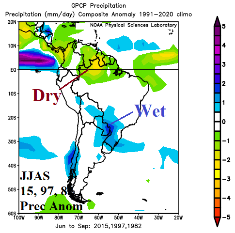
Regarding the cool season precipitation climate across South America during Super El Nino, the 2015, 1997, and 1982 episodes combine to produce a wet climate across Southeast Brazil and Paraguay while Northwest Brazil is very dry. The most recent Super El Nino (2015) produced a slightly wetter Southeast Brazil climate pattern.
05/13/2026, 12:25 pm EDT

El Nino Onset Ignites U.S. Pattern Change

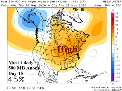
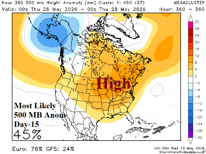
El Nino onset helps to inspire sharp upper-level low-pressure troughs in the subtropics to take advantage of the much warmer than normal Southeast Pacific, Gulf of Mexico, and tropical East Pacific SSTA patterns causing widespread low latitude heavy rains. Latent heat release poleward warms the atmosphere near the U.S./Canada border causing a warmer/drier pattern for the Northern U.S. later this month.