07/15/2026, 4:33 am EDT

Record Warmth Centered on Paraguay Ahead!

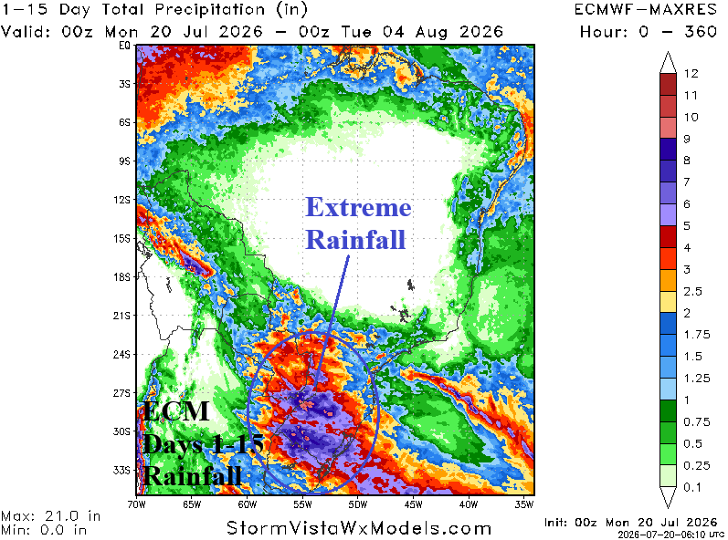
Titanic high pressure spawns record warmth through the next 7 days centered on Paraguay where temperature anomalies for the period exceed +20F! Meanwhile either side of the high-pressure ridge finds significant rainfall in Northeast Brazil and Southeast Brazil, south of coffee areas.
07/14/2026, 8:27 am EDT

Global Wind Oscillation Phase_7 Encourages -NAO Pattern To (Eventually) Cool East U.S./East Europe

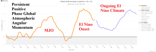
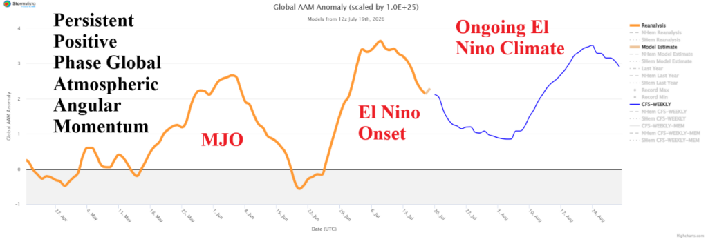
A strong positive phase global atmospheric angular momentum combined with the convection phase of the Madden Julian oscillation in the tropical East Pacific helps to force a semi-permanent global wind oscillation in phase_7. In this regime, there is a tendency to force negative North Atlantic oscillation. -NAO ahead forces an upper ridge near and southeast of Greenland with compensating upper troughs in northeast/east portions of North America and through Eastern Europe. Cooling results for Eastern Europe and eventually the Eastern U.S.
07/13/2026, 7:26 am EDT

Widespread Heat Next 5 Days

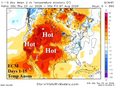
GFS ENS projects patchy >100F risk across many parts of the U.S. through the next 5 days while much of the nation observes >95F.
07/13/2026, 6:21 am EDT

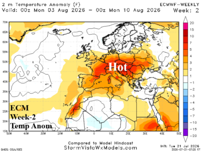
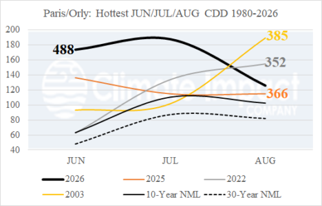
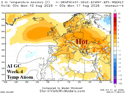
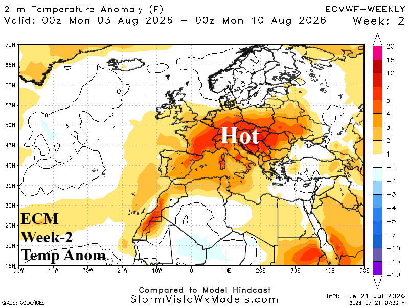
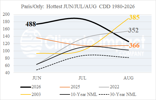
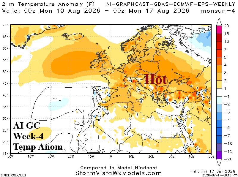
AG Market Early Alert: Europe heat this week, abates next week, but additional heat for late summer.

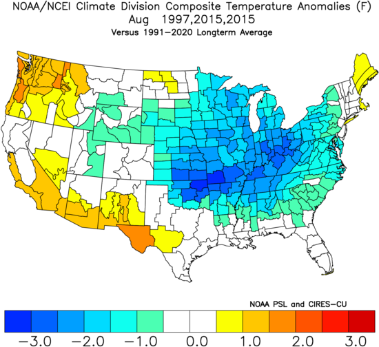
The latest Climate Impact Company constructed analog forecasts of temperature and precipitation anomalies during August favor hot and dry climate affecting most of Europe. Although still hot, periods of thundershowers are likely in France. A wet bias develops on South-coastal Europe. The hot/dry bias for Western Europe early-to-middle summer shifts eastward in August.
07/13/2026, 5:14 am EDT

Latest U.S. CDD Assessment for Summer 2026

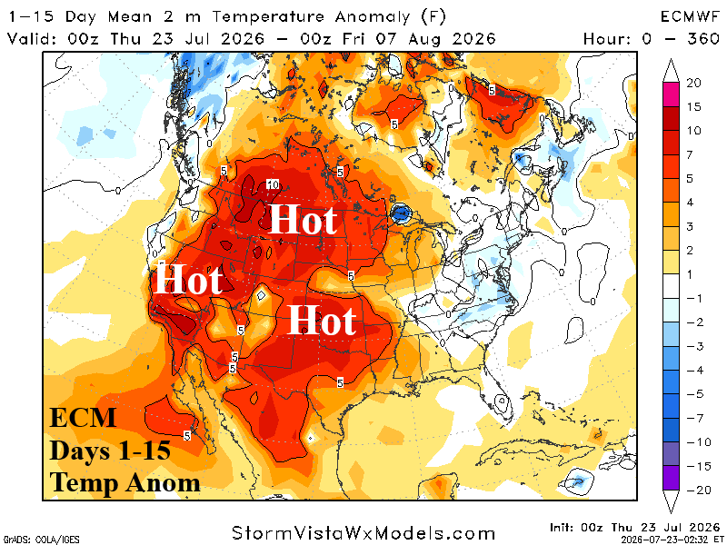
The latest Climate Impact Company U.S. cooling degree day assessment for summer 2026 given the recent decline in natural gas prices. Regenerating important warmth is likely for later summer while hotter operational models continue to battle cooler AI forecasts in the extended range.
07/09/2026, 12:30 pm EDT

Ranking June 2026 State Climate Rankings

June 2026 ranked 28th warmest in the 132-year historical record. The anomalous warmth was motivated by MUCH ABOVE normal across the southwest quadrant of the U.S., Northeast Corridor Coast, and Florida. Only Montana was slightly cooler than normal. The ongoing intense marine heatwave off the southwest coast of North America continues to provide the warm temperature bias to the Southwest U.S. while a much warmer western North Atlantic basin helped the East Coast shift warmer.
07/09/2026, 11:08 am EDT

Updating North Atlantic SSTA Regimes

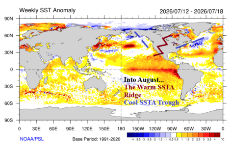
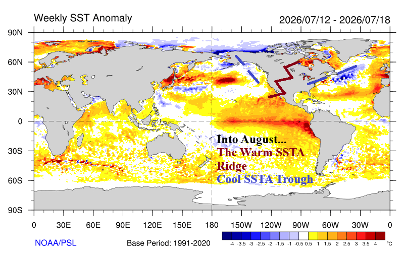
The North Atlantic basin has warmed 0.34C during the past 30 days to +0.70C, a (fairly) warm signature. However, the main development region is almost exactly normal and has cooled slightly in July so far. The Caribbean Sea warmed to +0.53C although all of the surface warming in in the northwest basin. The Gulf of Mexico is warming rapidly reaching +1.10C. The western North Atlantic basin has (also) warmed to +1.10C.
07/09/2026, 5:44 am EDT

Europe Drought Steadily Worsening

The ongoing Europe heatwave has not peaked. The latest 15-dy outlook indicates hottest days for Europe are July 14-15. The heatwave steadily loses intensity after the mid-month peak. The 8-14-day forecast projects expansive wet weather helping to ease the heat. The short-term heat and dryness will continue to worsen Europe Drought.
07/08/2026, 5:17 am EDT

France Heatwave, Nearly as Strong as June, Collapses Days 11-15

In Europe, the latest heatwave continues and is centered on France coupled with dryness and accelerating drought. The 15-day population weight daily average temperature maintains the heatwave for 10 days with intensity slightly less than the June episode. In the 11-15-day period relief is on the way as showers and thunderstorms streak into Europe.
07/07/2026, 4:40 pm EDT

Wetter Weather West/Southwest Europe Late Summer/Autumn

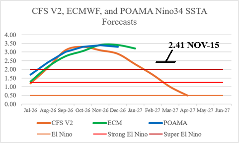
ECM “monthlies” maintain warmer than normal risk into the autumn season but due to El Nino influence begin a wet pattern across Southwest Europe next month likely to expand during autumn to help ease the drought.
07/07/2026, 9:25 am EDT

Week 3-5 Cooling Degree Projections Continue Hot ECM, Much Cooler AI

The estimated U.S. CDD forecast for week 3-5 ahead remains hot according to ECM while AI models are consistently much cooler. Interestingly, CFS V2 is sharply cooler for week-3 then bounces hotter for week-4/week-5. The primary issue is whether the East U.S. is hot (or not). The East cools off later July but should gradually reheat although not as aggressively as ECM. CFS V2 has the right “trend” and AI models are too cool.
07/06/2026, 5:14 am EDT

Does Aggressive +GLAAM Maintain Hot U.S. Temperature Bias Through JULY (Vs. Cooler AI Models)?

During late June/early July, emergence of a strong positive phase global atmospheric angular momentum (++GLAAM) regime has returned. The new surge of +GLAAM is related to the onset of an El Nino climate. Previously, a pulse of ++GLAAM was observed during late May/early June, elated to a strong Madden Julian oscillation (MJO) episode, and the correlating U.S. temperature anomalies were extremely warm, especially for the Central U.S.