01/19/2026, 12:53 pm EST

Arctic Air, Snow and Ice; Cold Blast East Finishes January!

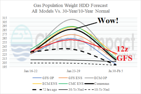
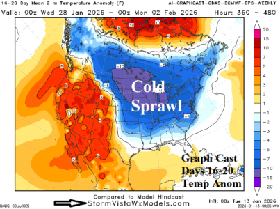
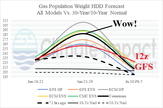
The next major issue for the U.S. is an arctic outbreak scheduled to arrive across the northern Great Plains Wednesday night, according to the just arrived 12Z GFS. On Thursday, the arctic boundary shifts southward reaching Des Moines to Chicago early evening, accelerating southward Thursday night to northwest Texas Friday morning and eastward across Arkansas to the Ohio Valley. By Friday afternoon, the arctic air is filtering through New England and into the northern Mid-Atlantic region southwestward to northern Texas.
01/16/2026, 10:26 am EST

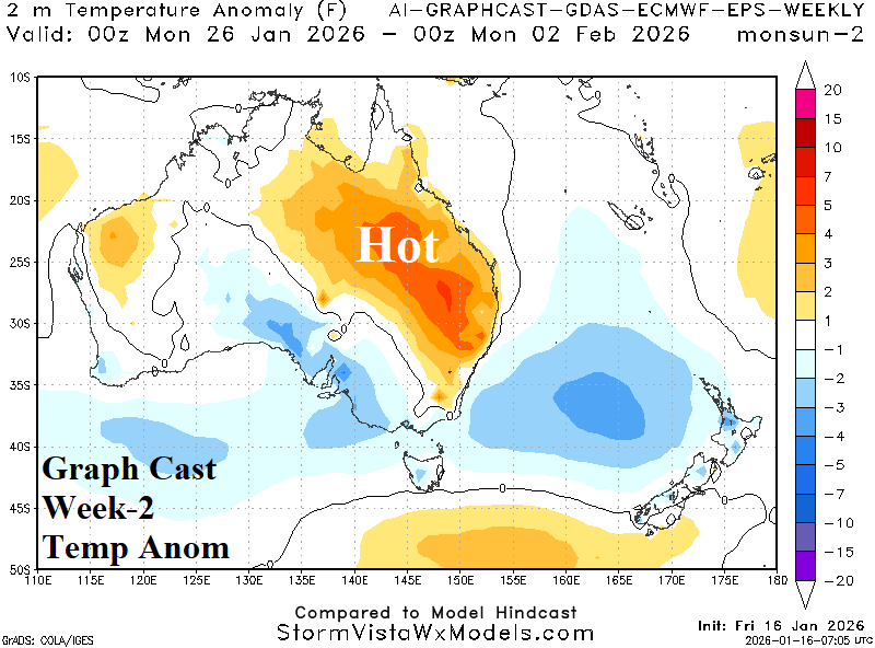
Shifting MJO Delivers Hot/Dry Changes to East Australia Late JAN/Early FEB

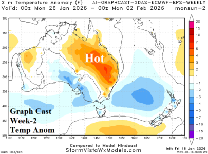
The ECM 30-day Madden Julian oscillation forecast indicates a phase_6 to phase_7 shift with intensity the second half of January followed by a phase_8 to phase_1 shift the first half of February. The phase_8 to phase_1 shift is eastward through the longitudes of the Americas and represents a hot and dry correlation to Australia climate.
01/16/2026, 10:23 am EST

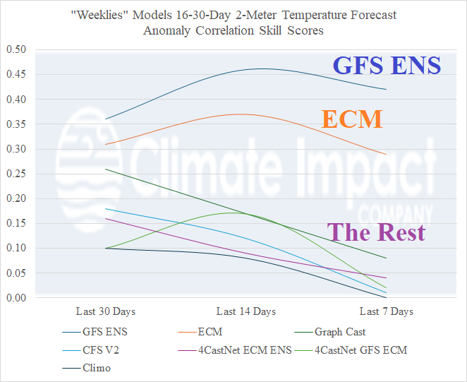
“Weeklies” Skill Scores for North America

The “weeklies” skill scores from the past 30, 14, and 7 days predicting 2-meter temperature forecasts for North America is horrible. The exception is, surprisingly, GFS ENS with traditional ECM “weeklies” a distant second.
01/16/2026, 5:47 am EST

Expect Snow Cover Expansion East U.S. Later January

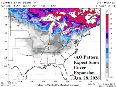
Regarding snow cover, the U.S. snow cover is below normal as mid-January arrives. However, given the lengthy negative arctic oscillation (-AO) the remainder of January, inevitable is a southward expansion of snow cover. The GFS snow depth forecast indicates Arkansas to the Tennessee Valley is snow covered in 2 weeks.
01/15/2026, 12:25 pm EST

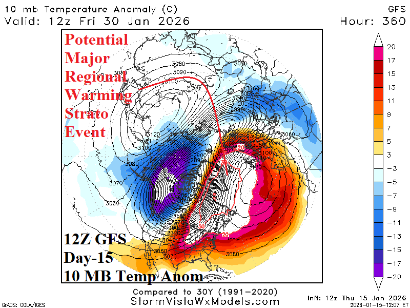
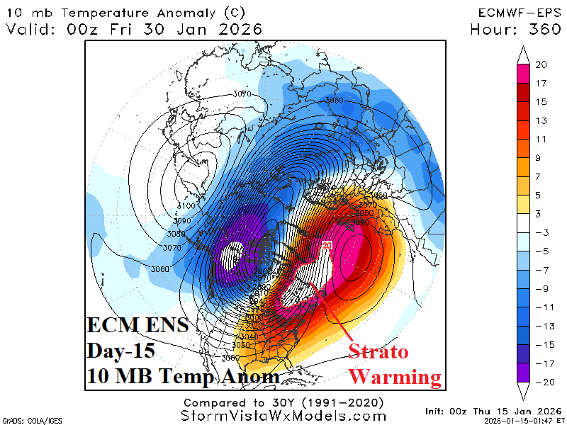
Regional Stratospheric Warming Episode Eastern North America Late January

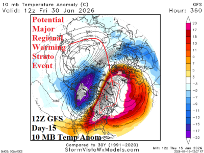
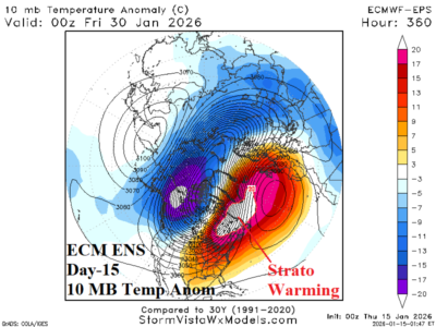
At midday, the 12Z GFS indicates evolution of a significant REGIONAL STRATOSPHERIC WARMING EVENT across eastern North America occurring mid-to-late 11-15-day period. The warming is likely in response to a moderate to strong eastward shifting convection phase of the Madden Julian oscillation (MJO) across the equatorial Pacific.
01/15/2026, 9:04 am EST

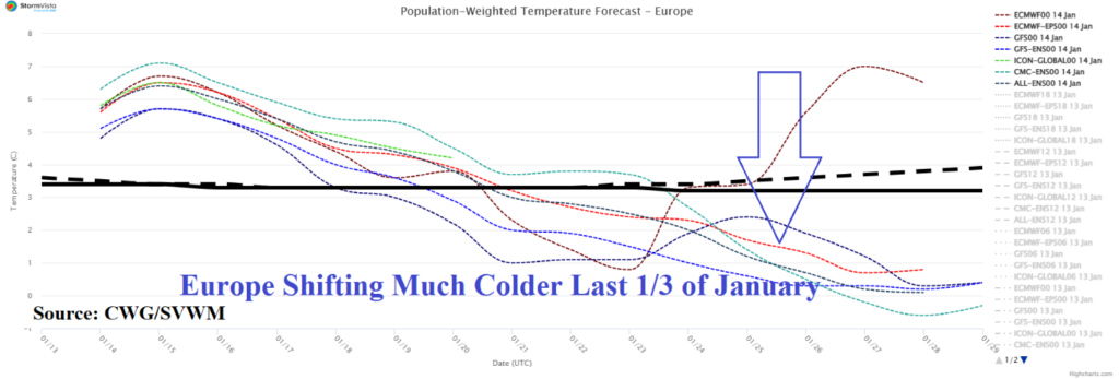
Regional Stratospheric Warming Expands Westward to North America East Coast Late January; Causes East U.S. Chill

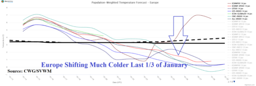
A frigid Russia air mass inspired in-part by regional stratospheric warming shifts westward into Europe during the medium range as the stratospheric warmth also shifts westward to the North Atlantic in 11-15 days. By late month, the stratospheric warming reaches eastern North America and should cause a cold ending of January/beginning of February for eastern North America.
01/14/2026, 12:42 pm EST

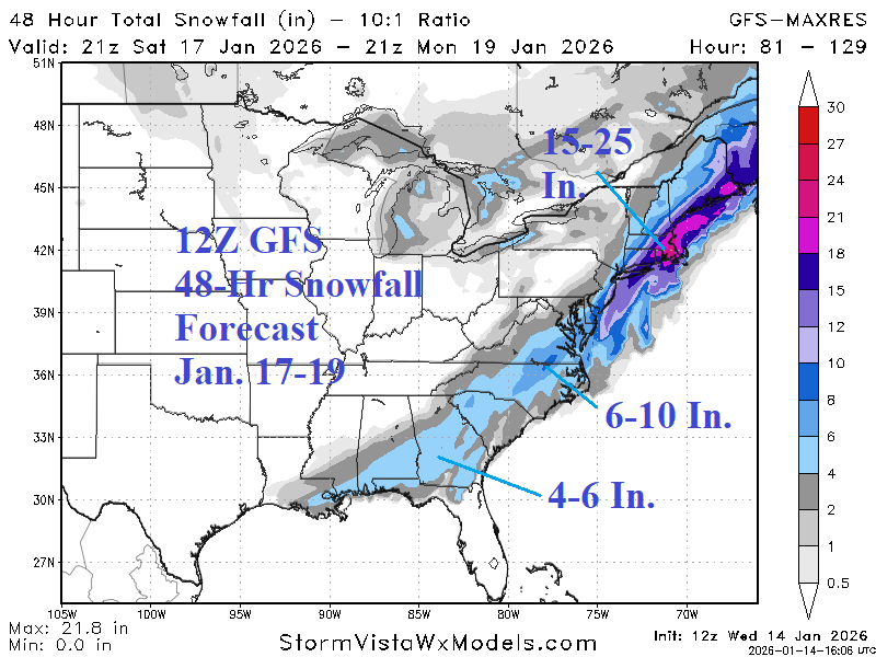
Strong -AO, Sneaky Cold and Snowy Surprises Possible

Is the heavy snowstorm indicated by 12Z GFS on the East Coast early next week correct. Of course not! However, the model makes the point that the climate pattern is in a strong negative arctic oscillation. Arctic air is forecast to drift cross-polar from Siberia and infiltrate North America. In this pattern, a snowstorm in the East is possible
01/14/2026, 4:12 am EST

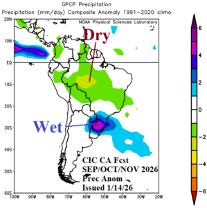
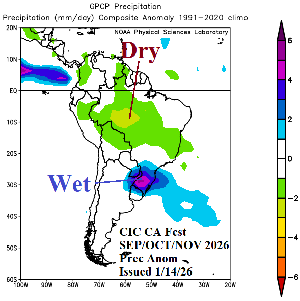
An El Nino South America Climate to Develop in 2026!

Into mid-year through early next year, the South America climate forecast is primarily reliant on the arrival and intensification of El Nino. Forecast highlights include a hot and dry Southeast Brazil regime in February followed by a mostly dry Brazil during autumn while lingering anomalous heat affects Argentina. The winter season is milder than normal. Next spring and summer are mostly hotter/drier than normal across Brazil away from the coast.
01/13/2026, 12:34 pm EST

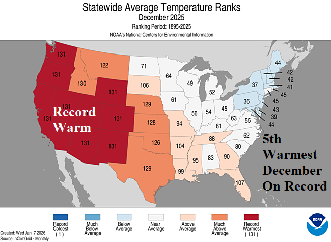
5th Warmest December on Record in U.S.

DEC-25 was the 5th warmest early winter in the 131-year historical record. Almost the entire West observed the warmest December on record while the Northeast was seasonably cold. The U.S. precipitation pattern during DEC-25 ranked 37th driest on record featuring the driest December on record in Oklahoma with near record dryness for surrounding states, a classic La Nina signature. Meanwhile a wet La Nina bias was exceptional across the Northwest States.
01/13/2026, 6:08 am EST

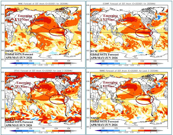
El Nino Alert Ahead!

Upper ocean heat east of the Dateline in the equatorial East Pacific is steadily increasing. The warming is attributed to an eastward shifting Kelvin Wave which has increased intensity during January. The upper ocean heat warming is similar with 2023 ahead of an El Nino event that developed later that year. Global SSTA forecasts have adjusted to the evolving El Nino scenario for quarter 2 of 2026.
01/13/2026, 4:07 am EST

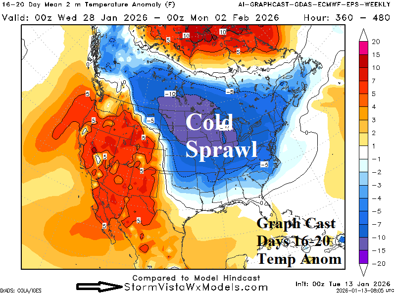
Long Duration -AO Pattern Eventually Supports Cold Return to North/East U.S.

The 15-day AO outlook strengthens the negative phase. The projected JAN-26 value is near -2.0 rivaled most recently by JAN-21 (-2.4) and JAN-10 (-2.6). Right now, arctic air mass stretches across Eurasia. During the 6-10-day period, the 500 MB anomaly outlook projects a “ridge bridge” over Alaska. The upper ridge causes a cross-polar low-level air mass trajectory taking arctic air from Russia into North America.