News
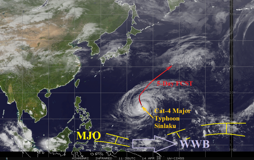
04/14/2026, 12:34 pm EDT

Plethora of East Great Plains Severe Weather This Week

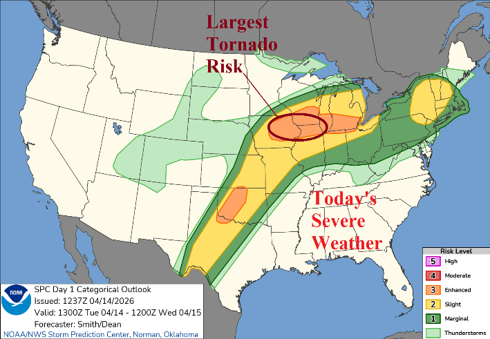
Negative Pacific North America (-PNA) pattern assures a cool regime in the West clashing with very warm temperatures in The Central and East to cause daily severe weather outbreaks into the weekend. Today, severe thunderstorms are forecast by NOAA/SPC from Texas to the Midwest States pulsing eastward to New England. The greatest tornado risk is located from Des Moines, IA to Chicago, IL. Tornado risk is evident in Oklahoma.
04/14/2026, 11:29 am EDT

South America Week 2-4 Outlook: Brazil shifts drier; Hot Southeast Brazil.

MJO forcing causes a heavy rain scenario across Northern Argentina/Paraguay and Northeast Brazil the next 7-10 days. However, tropical involvement is diminished in the extended range as Brazil shifts much drier. Dry soils in Southeast Brazil increase the risk of steady late season anomalous heat.
04/14/2026, 9:39 am EDT

Unusual Early Season West Pacific Major Typhoon Sinlaku Indicates Potential for Busiest North Pacific TC Season on Record

A strong westerly wind burst (WWB) in the Pacific Ocean tropics between 140E and 160E also located across warm sea surface temperature anomalies (SSTA) and robust subsurface upper ocean heat helped spawn an early season unusually strong category-5 major typhoon (Sinlaku). The ingredients helping to ignite this early season intense storm to develop are shifting eastward and will ignite El Nino in May with rapid intensification likely to follow.
04/13/2026, 12:03 pm EDT

Immense Subsurface Kelvin Wave East of Dateline Promises Intense El Nino Ahead in 2026

Neutral ENSO continues during early April as the Nino34 SSTA is unchanged at +0.2C. Last week, some warming was observed off the northwest coast of South America (Nino12). The subsurface upper ocean heat is MUCH warmer than normal and intensifying. The NEW Kelvin Wave features ocean temperatures 6-7C warmer than normal extending to just east of 150W and further eastward shifting is likely.