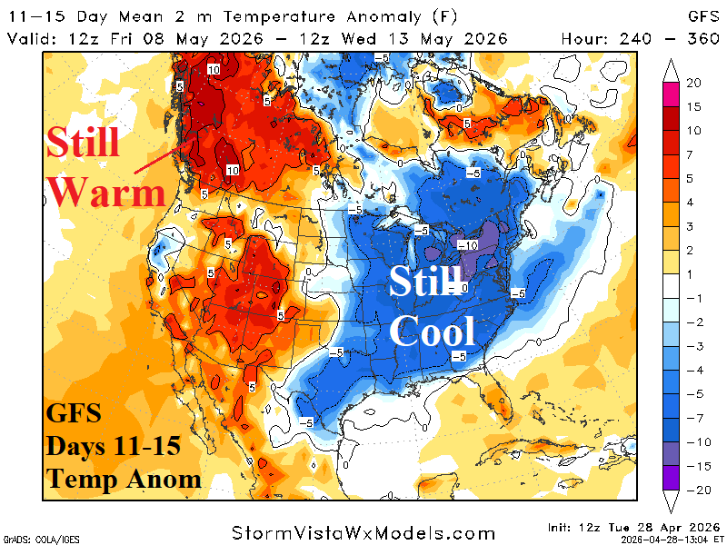
Despite support for a warmer East U.S. 11-15-day forecast from climate signals, GFS stays chilly in the East. The chilly East regime is compensated by very warm weather in Southwest Canda to the West U.S.
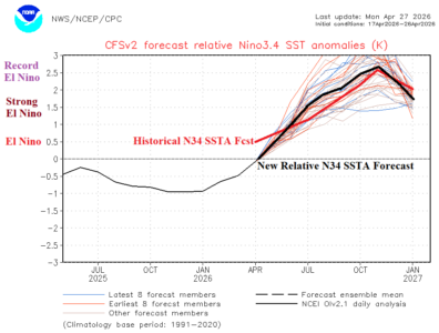
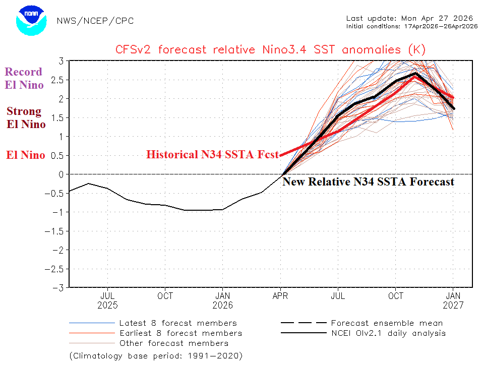
The traditional Nino SSTA weekly observations indicate the El Nino threshold is surpassed by all Nino regions. However, the new relative Nino index maintains neutral ENSO phase. The relative Nino SSTA are moderately cooler than historical indices. As of earlier this year, the relative Nino index is used to identify and forecast ENSO phase by NOAA and Australia Bureau of Meteorology.
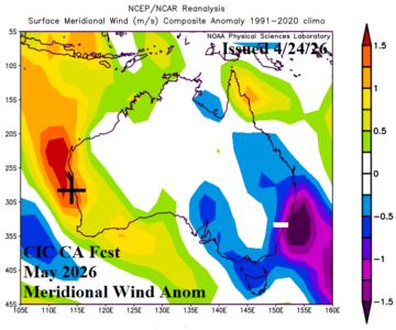
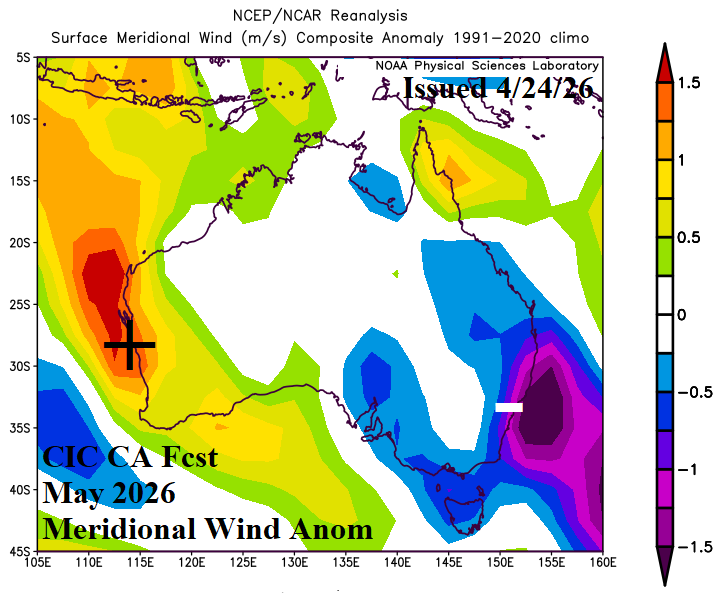
The Australia month 1-3 ahead wind speed forecast is presented using two methodologies: 1.) Climate Impact Company constructed analog for zonal and meridional wind directions and 2.) ECMWF probabilistic outlook. ECMWF is generally indicating lighter than normal wind speeds for the 3-month period except above normal wind speeds for the Southeast Coast during JUN/JUL (agreeable to the CIC-CA outlook).
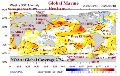
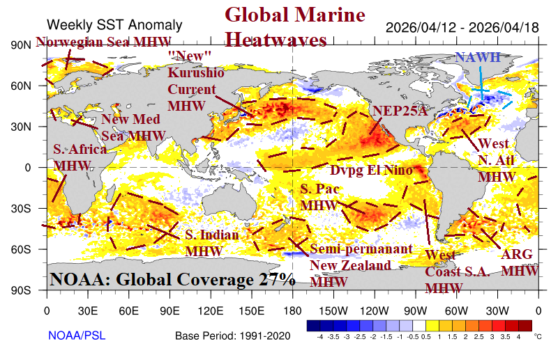
According to NOAA, aerial coverage of global marine heatwaves (MHW) is 27%. The forecast for aerial coverage from early this year, valid for March, was 23%. Consequently, MHW presence is over-achieving. NOAA is forecasting MHW aerial coverage to increase to 40% later this year, in part due to El Nino.
