06/05/2026, 12:46 pm EDT

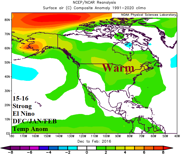
DEC/JAN/FEB During Strong El Nino for NA, EU, SA, and AU

A glimpse at historical climate pattern across North America, Europe, South America, and Australia for DEC/JAN/FEB during strong El Nino is reviewed. Only 2 strong El Nino’s have occurred during the past 2 years. The most recent (2015-16) is likely more representative of DEC/JAN/FEB 2026-27 due to the occurrence of strong El Nino during accelerated global oceanic warming.
06/04/2026, 2:46 pm EDT

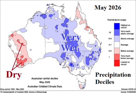
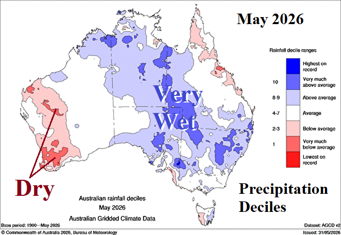
El Nino Dry Climate Not Yet in Australia

During May 2026, the prevailing upper air pattern featured an upper trough across western continent with a compensating ridge in the East. The upper trough was causal to heavy rain across central and eastern continent during May while the upper ridge warmed New South Wales. The wet pattern during May was primarily related to the proximity of the Madden Julian oscillation.
06/04/2026, 12:13 pm EDT

El Nino Climate Onset Arrives

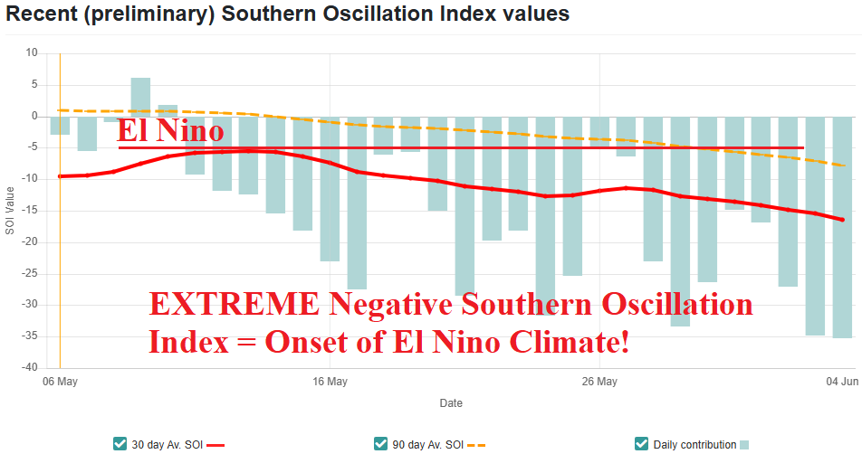
A westerly wind burst has formed in the tropical Pacific Ocean stretching eastward past the Dateline in the wake of a moderate-to-strong Madden Julian oscillation (MJO) episode. The MJO event has caused significant lowering of pressure in the tropical East Pacific to cause an exceptionally strong negative phase of the southern oscillation index to develop (Fig. 3). The emerging -SOI regime is an indicator that an El Nino climate has arrived and is developing rapidly.
06/04/2026, 5:48 am EDT

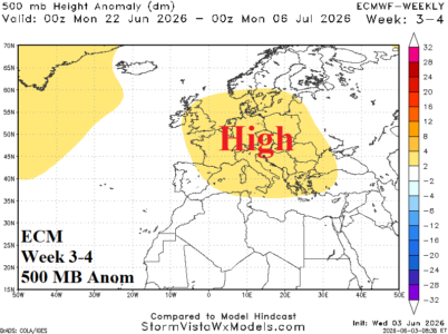
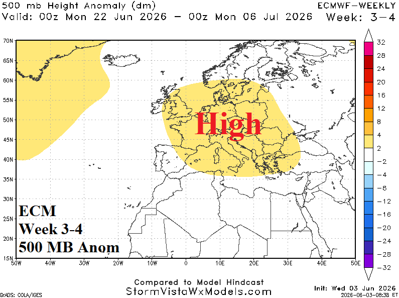
Marine Heatwave Inspires Europe Hot/Dry High Pressure Ridge Later June; MJO/SOI Inspired El Nino Climate Onset; Brazil Freeze Days 11-15?

An immense heatwave south and west of Europe is intensifying, typical of the past 10 years during June in this region. The MHW is well-correlated to a summertime 500 MB hot/dry ridge across Europe forecast by ECM "weeklies" in the week 3-4 outlook. Meanwhile, an intense Madden Julian oscillation has caused southern oscillation index into an extreme negative phase signaling the onset of an El Nino climate. Forecast models indicte risk of important cold into Brazil in the 11-15-day period.
06/03/2026, 1:47 pm EDT

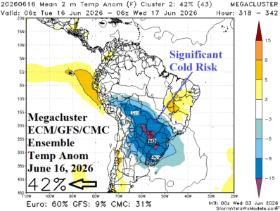
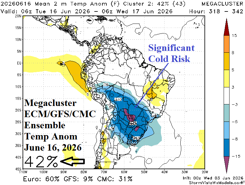
South America Cold Weather Threat Mid-June

The mega-cluster ensemble combining ECM, CFS, and CMC output indicates risk of significant cold not far from Brazil coffee-growing areas on June 15-16.
06/03/2026, 8:49 am EDT

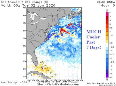
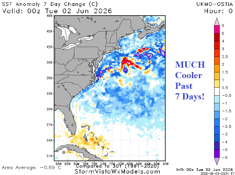
Western North Atlantic SSTA Cool Off Sharply

The western portion of the North Atlantic basin except for the Gulf of Mexico is shifting dramatically cooler. SSTA are extremely cool off the Northeast. The 7-day change is sharply cooler. Usually, large areas of cool SSTA bias the local climate cool.
06/03/2026, 8:08 am EDT

Sharp Differences in Crop Conditions In U.S./Canada

Canadian spring wheat was sharply affected by drought in the southwest/south sector, but recent rains have been substantial increasing wet soil concerns, especially in the eastern half of the crop area. The U.S. spring wheat area is generally OK although weather/soil conditions is variable and require careful monitoring. U.S. Corn is ahead of schedule while winter wheat crop ratings are poor due to drought and late season freezes although recently gaining some rainfall.
06/02/2026, 7:45 am EDT

Mid-June U.S. Pattern Change

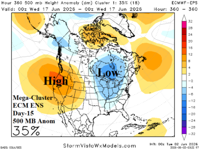
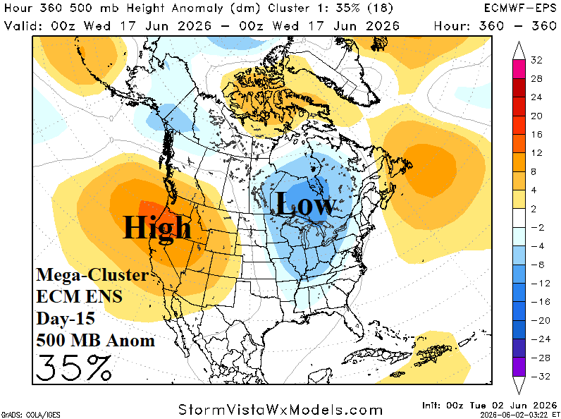
The Madden Julian oscillation (MJO) shifts across the warm eastern equatorial Pacific during the next 1-2 weeks. U.S. climatology during an MJO phase_7 to phase_8 transition favors a cooler East U.S. regime. Although not super confident, the most likely (ECM ENS mega-cluster ensemble) upper air pattern in 15 days is a new upper trough centered on Ontario to deliver cooler weather into the East U.S.
06/01/2026, 9:07 am EDT

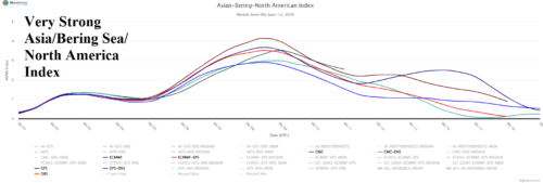
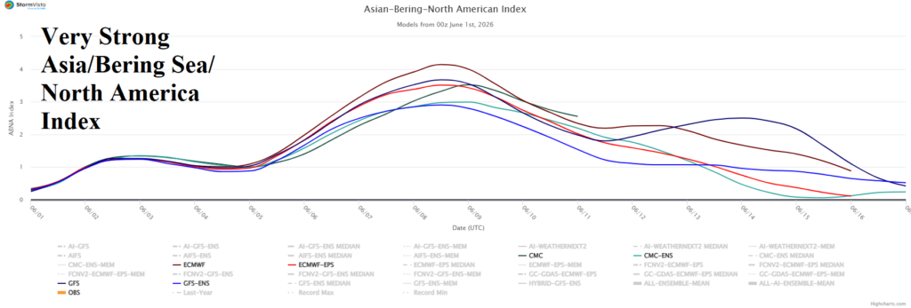
+ABNA Index Dominates North America Climate Signals

The Asia/Bering Sea/North America (ABNA) index remains very positive and is the lead climate signal influence on the North America upper air pattern for the first half of June. The +ABNA regime is present when a strong trough is near the Bering Sea and compensated for by an upper ridge over East-central North America.