03/05/2026, 4:52 am EST

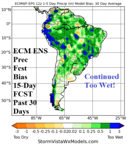
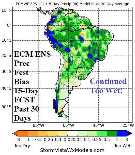
Wetter 15-Day Forecasts for South America; Be Aware of Ongoing Wet Bias for Forecasts

Northeast Brazil is shifting much wetter and parts of Northeast Argentina are also thundery. 15-day forecasts are wetter across both Brazil and Argentina. One catalyst to the potentially wetter regime is the increased moisture availability of warm SSTA off the West Coast and Nino12 SSTA region. Keep in mind, ongoing wet bias remains with all models in 15-day forecasts.
03/04/2026, 8:19 am EST

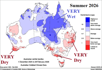
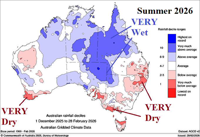
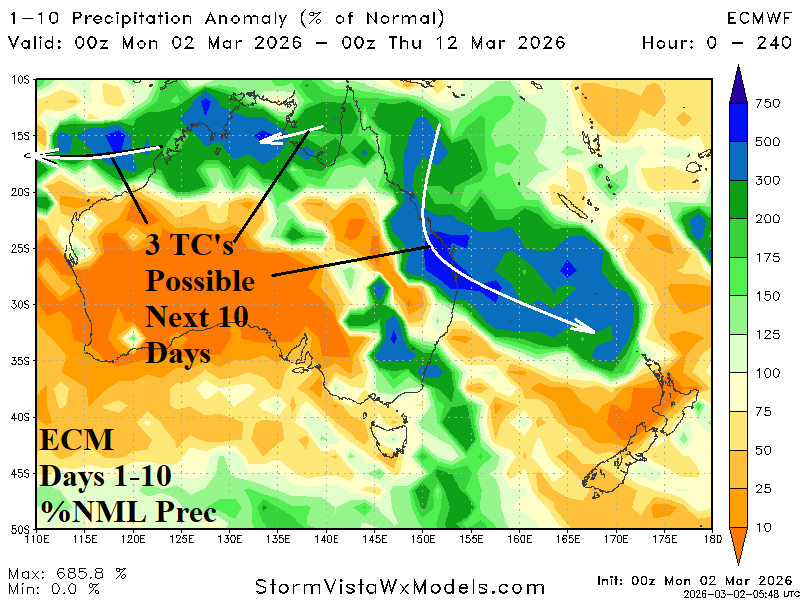
Summer 2025-26 Featured Climate Extremes Across Australia

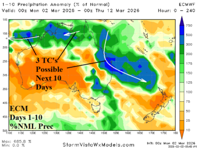
Meteorological summer 2025-26 produced harsh climate extremes across Australia. Most of the southern half of Australia observed MUCH ABOVE normal anomalous heat. The heat was accompanied by locally very dry climate in parts of Victoria and Northeast New South Wales plus Coastal Southwest Australia. However, summer 2026 will be remembered for prohibitive rainfall centered on the east-central to northeast continent which became enhanced to an all-time-record level during February.
03/04/2026, 8:16 am EST

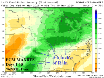
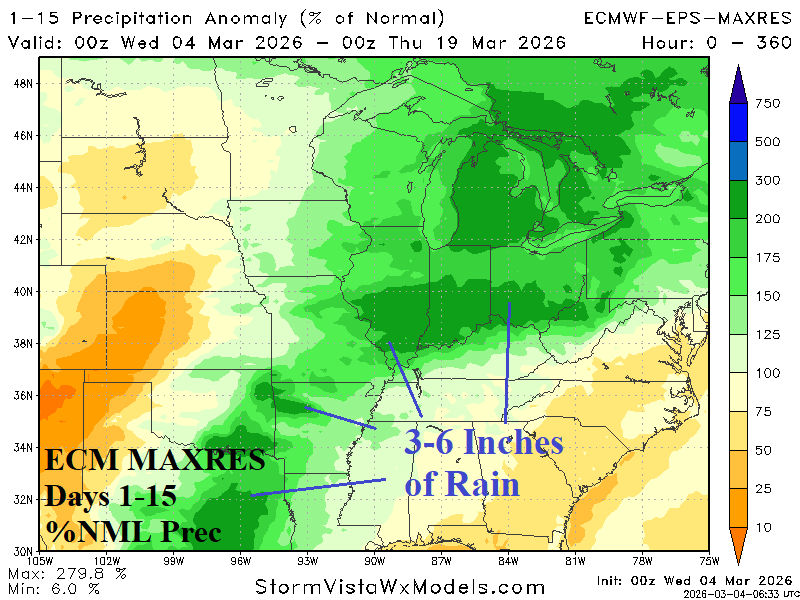
Lengthy Mid-south/Midwest U.S. Wet Weather Pattern Ahead

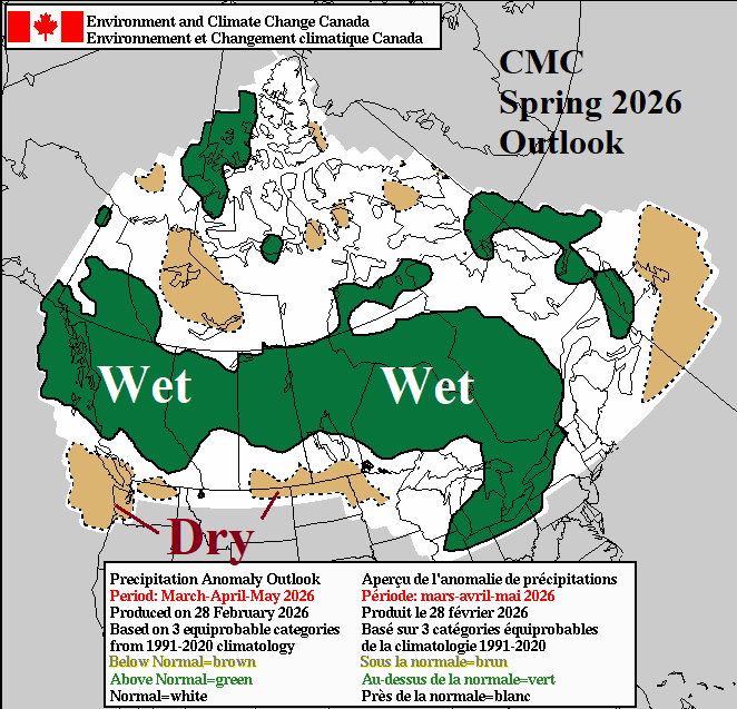
The U.S. weekly evaporative drought demand index (EDDI) valid for late February indicates parts of the U.S. most susceptible to drought or flash drought as the warm season arrives is the Gulf States, parts of the Southwest U.S., and central U.S. Corn Belt. If areas listed shifted into a dry climate as the warm season arrives, rapid drought development/intensification would generate in these zones. However, the U.S. precipitation pattern is forecast to change through the next 30 days featuring above too much above normal precipitation in Texas to the Ohio Valley in the latest 15-day outlook likely to continue in the week 3-4 period.
03/03/2026, 3:00 pm EST

Coldest (Norfolk, VA) and Warmest (Phoenix, AZ) HDD Observations for U.S. Meteorological Winter 2025-26

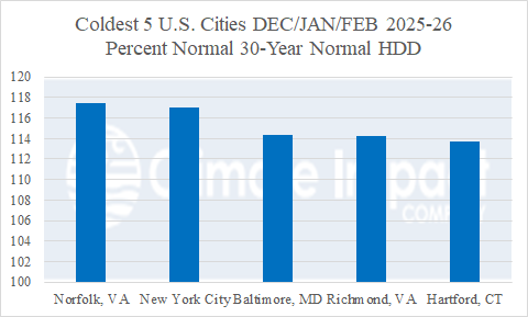
Reviewing the Climate Impact Company U.S. heating degree day (HDD) count for selected cities reveals the coldest location for meteorological winter 2025-26 was Norfolk, VA where 117.4% of the 30-year normal HDD was observed. Values above 110% are considered MUCH BELOW normal temperature (or MUCH HIGHER than normal heating demand). Norfolk was followed closely behind by New York City (117.0%), Baltimore, MD (114.3%), Richmond, VA (114.2%) and Hartford, CT (113.7%).
03/03/2026, 5:49 am EST

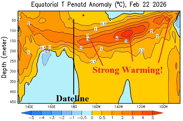
East Pacific Upper Ocean Heat Immense; Atmosphere Still in La Nina Mode

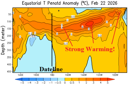
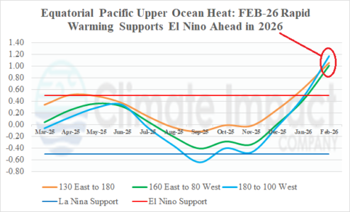
The eastern equatorial East Pacific subsurface is impressively warm and continues to warm, the strongest (warm) signature since Q2/2023. However, at the surface, only the Nino12 region has warmed significantly (+1.23C). The Nino34 region remains slightly cooler than normal (-0.11C) confirming neutral ENSO phase.
03/01/2026, 6:40 am EST

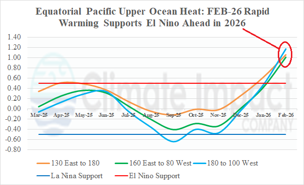
Rapid Warming of the Pacific Ocean Subsurface in February 2026

During February, robust warming of the equatorial Pacific Ocean subsurface was observed and supports an El Nino ahead climate signal. The last months when the entire equatorial Pacific subsurface were warmer than +1.0C was observed during April-June 2023 when Nino34 SSTA was +0.88C by June on the way to +1.99C by December. Multivariate ENSO index (MEI) shifted to an El Nino supporting +0.5 in June (2023) peaking at +1.1 in December.