News
01/14/2026, 4:12 am EST

An El Nino South America Climate to Develop in 2026!

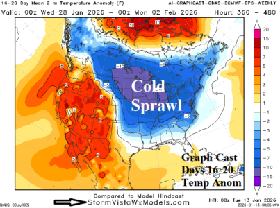
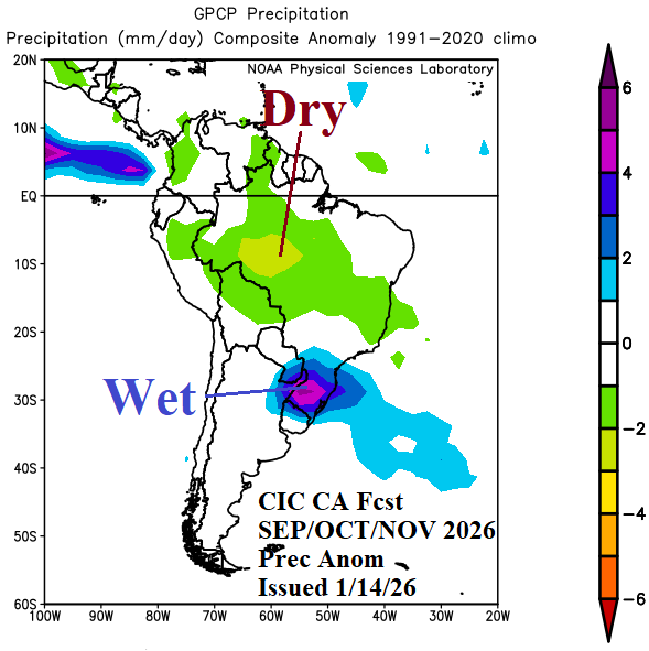
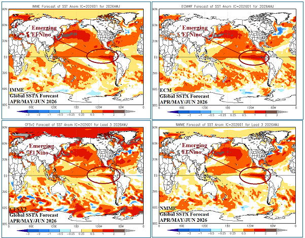
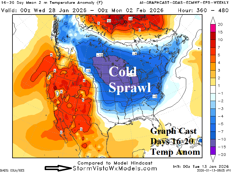
Into mid-year through early next year, the South America climate forecast is primarily reliant on the arrival and intensification of El Nino. Forecast highlights include a hot and dry Southeast Brazil regime in February followed by a mostly dry Brazil during autumn while lingering anomalous heat affects Argentina. The winter season is milder than normal. Next spring and summer are mostly hotter/drier than normal across Brazil away from the coast.
01/13/2026, 12:34 pm EST

5th Warmest December on Record in U.S.

DEC-25 was the 5th warmest early winter in the 131-year historical record. Almost the entire West observed the warmest December on record while the Northeast was seasonably cold. The U.S. precipitation pattern during DEC-25 ranked 37th driest on record featuring the driest December on record in Oklahoma with near record dryness for surrounding states, a classic La Nina signature. Meanwhile a wet La Nina bias was exceptional across the Northwest States.
01/13/2026, 6:08 am EST

El Nino Alert Ahead!

Upper ocean heat east of the Dateline in the equatorial East Pacific is steadily increasing. The warming is attributed to an eastward shifting Kelvin Wave which has increased intensity during January. The upper ocean heat warming is similar with 2023 ahead of an El Nino event that developed later that year. Global SSTA forecasts have adjusted to the evolving El Nino scenario for quarter 2 of 2026.
01/13/2026, 4:07 am EST

Long Duration -AO Pattern Eventually Supports Cold Return to North/East U.S.

The 15-day AO outlook strengthens the negative phase. The projected JAN-26 value is near -2.0 rivaled most recently by JAN-21 (-2.4) and JAN-10 (-2.6). Right now, arctic air mass stretches across Eurasia. During the 6-10-day period, the 500 MB anomaly outlook projects a “ridge bridge” over Alaska. The upper ridge causes a cross-polar low-level air mass trajectory taking arctic air from Russia into North America.