10/13/2025, 7:11 am EDT
A diagram of a person's face AI-generated content may be incorrect.

Transitional MJO Weakens Strong -GLAAM; Highly Amplified Mid-latitude Pattern to Ease

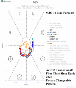
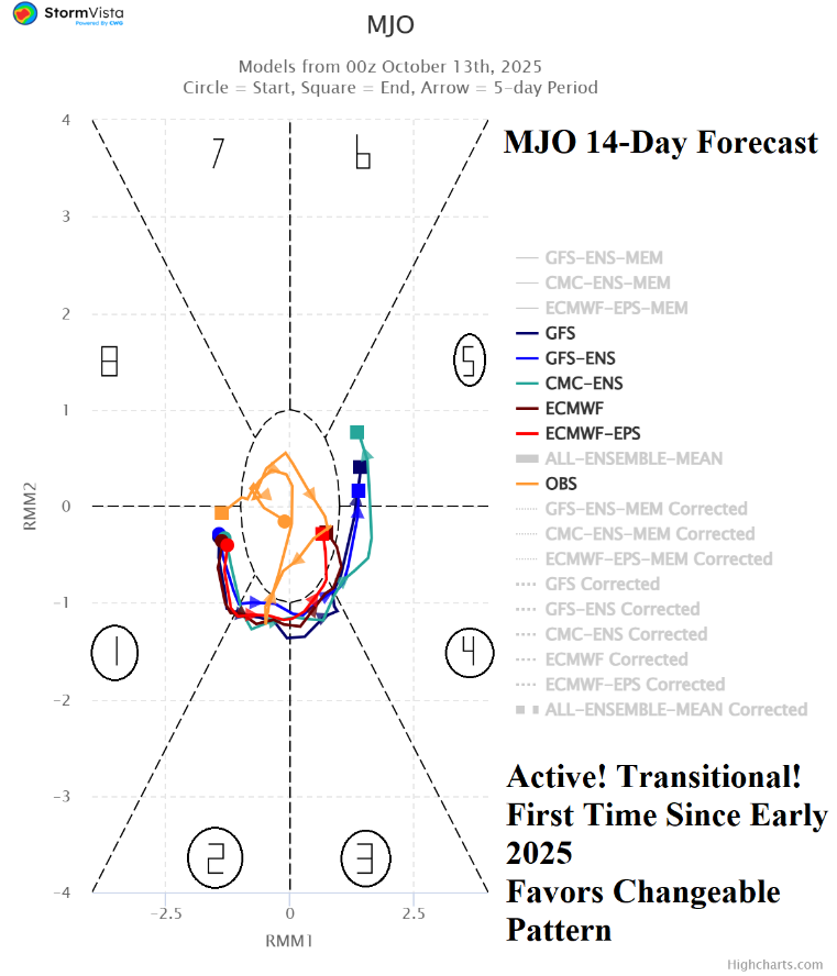
For the first time since earlier in the year, the convection phase of the Madden Julian oscillation (MJO) is moderately intense AND transitional. Implied is the slow demise of a tendency for a highly amplified trough/ridge pattern in the middle latitudes as supported by the 15-day global atmospheric angular momentum (GLAAM) forecast which maintains the negative index but with less amplitude.
10/13/2025, 6:05 am EDT
A map of australia with different colors and numbers AI-generated content may be incorrect.

The Surprising Dry Climate in Australia

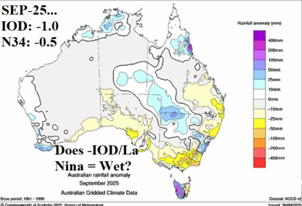
In a surprise, the month of September and especially October (so far) have averaged drier than expected considering the normally wet bias Australian climate produces when Indian Ocean dipole (IOD) is negative and La Nina is developing. The dry and increasingly warmer than normal pattern, especially in the East (and more recently across the North) is due to negative phase of the southern annular mode (-SAM) or negative Antarctic oscillation (-AAO) in that anomalous high pressure covers Antarctica forcing strong mid-latitude upper troughs, one of which is south of Southeast Australia.
10/09/2025, 5:26 am EDT
A map of the north and central coast AI-generated content may be incorrect.

Caribbean/Gulf Subsidence/Dry Air Suppressed North Atlantic Seasonal Tropical Cyclone Activity

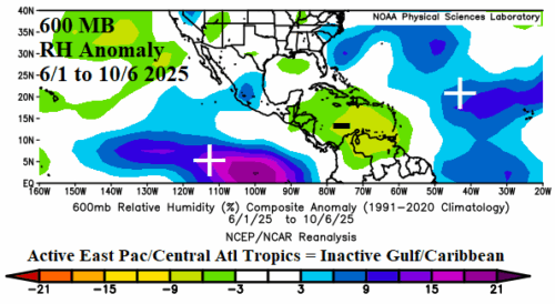
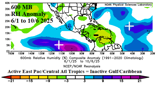
So far, the Caribbean Sea has not observed a tropical cyclone in 2025 while only 1 tropical cyclone formed in the Gulf of Mexico. The last time each basin was inactive to this extreme were during strong El Nino years (1997, no activity in The Caribbean and 2015, 1 tropical cyclone in the Gulf of Mexico). Part of the explanation is the mid-troposphere anomalous dry air strongly identified in the Caribbean Sea since June.
10/08/2025, 6:09 am EDT
A graph of a graph with different colored lines AI-generated content may be incorrect.

Weal La Nina Ahead; Possible El Nino Mid-2026

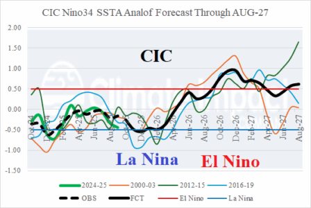
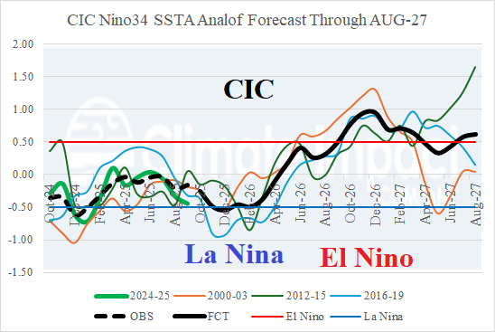
A weak La Nina is forecast for Q4/2025 shifting to neutral phase during early 2026 and possibly to El Nino during the middle of next year. A strong ENSO episode within the next 12 months is not expected although forecast confidence in a phase change is reasonable.
10/08/2025, 5:59 am EDT
A map of the weather AI-generated content may be incorrect.

Record Heat May Develop in Australia

The convection phase of the Madden Julian oscillation (MJO) is alive shifting eastward across the East Pacific tropics to tropical Africa and eventually western tropical Indian Ocean during the next 2 weeks. Intensity is marginal although ECM indicates weak-to-moderate intensity. Usually, an MJO shift through phase_1/phase_2 increases risk of hot and dry weather in Australia and a wetter regime for South America.
10/07/2025, 5:22 am EDT
A map of the weather AI-generated content may be incorrect.

Titanic Hot High-pressure Ridge Mid-October for Australia!

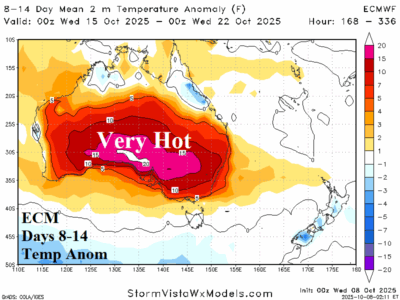
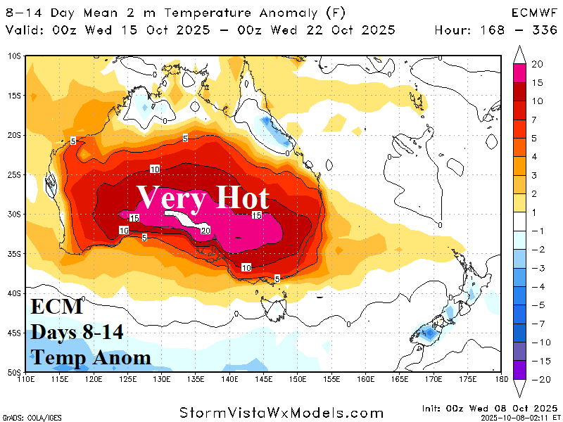
All forecast models are agreeable on a building high pressure ridge which delivers a hot mid-October to Australia. On the northern fringe of the ridge, monsoon rain affects northwest/north continent. However, East/Southeast Australia is very dry.
10/07/2025, 5:18 am EDT
A map of south america with different colored areas AI-generated content may be incorrect.

South America Rainfall Forecast Bias; Week 2-4 Outlook

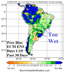
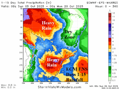
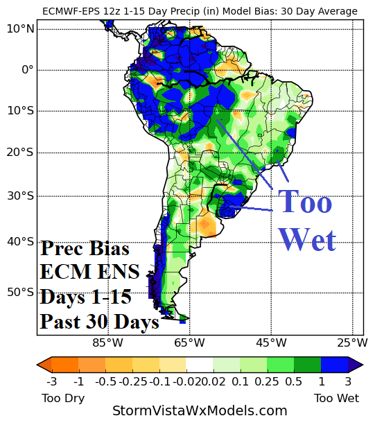
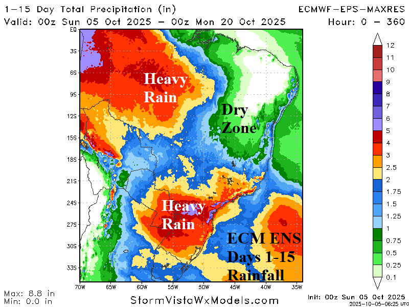
The ECM/ECM ENS continue a wet forecast bias across northwest South America, much of Brazil, and Uruguay during the past 30 days for all 15-day forecasts. This wet bias increases during the medium (6-10-day) and extended (11-15-day) range. The GFS/GFS ENS has a dry bias for West Brazil and Paraguay/Southeast Brazil.
10/06/2025, 7:11 am EDT
A map of the north and south america AI-generated content may be incorrect.

Influence on South America Climate of the Coastal Brazil Upper-level Low-pressure Area

Important as a review, is the influence on summertime rainfall patterns in South America by a semi-permanent upper-level low pressure trough located off the Southeast coast of Brazil for most years in this decade. The just-issued ECMWF “monthlies” are forecasting the presence of this low-pressure system for early-to-middle summer.
10/05/2025, 1:27 pm EDT
A graph showing the number of negatives AI-generated content may be incorrect.

Evolving -NAO Pattern Could Cool East U.S. in Extended-range

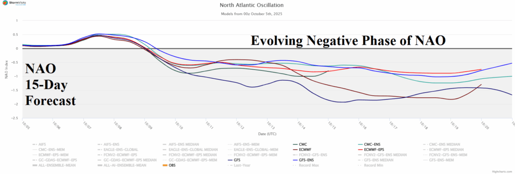
The latest North Atlantic oscillation (NAO) 15-day forecast reveals an evolving moderate-to-strong negative phase usually causal to a blocking high pressure over Greenland and a compensating upper trough into the Northeast U.S. Forecast models have resisted that forecast solution over the weekend, however, at 12Z today, the GFS follows the -NAO guide.
10/05/2025, 10:04 am EDT
A map of the weather AI-generated content may be incorrect.

Most, Not All, Brazil Soybean Areas Are Wetter

Departing September, GRACE-based soil moisture anomalies analysis reveals improving conditions in the central/east-central Brazil soybean-growing areas while harsh drought in the southern soybean-growing areas receives beneficial rainfall in the latest 15-day outlook. The far eastern soybean growing-areas remain in drought with a dry outlook during the next 15 days.
10/02/2025, 4:43 am EDT
A map of australia with different colored spots AI-generated content may be incorrect.

Borderline La Nina/-IOD Pattern Under-performing as Rainmakers in Australia

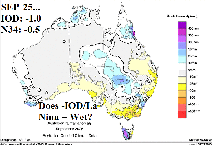
Negative Indian Ocean dipole (-IOD) contributes to Central and East Australia rainfall during winter and spring while La Nina biases eastern continent wet. Both climate signals emphasize a wet bias to Australia climate and diminish dry risk. The -IOD regime is well established while borderline weak La Nina is present but without a clear atmospheric response. Consequently, the anticipated wet climate for early spring is patchy, based on September rainfall terciles. Note the dryness in key Australia crop areas in Victoria and eastward.
10/01/2025, 6:58 am EDT
A graph showing the difference between the average and the average AI-generated content may be incorrect.

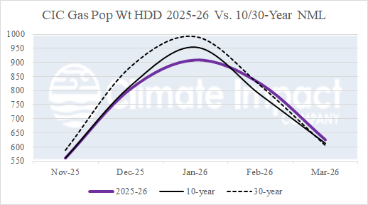
U.S. Winter Gas Population Weight HDD Biased Mostly Warm

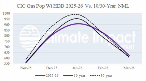
Since last month, it’s getting more difficult to make the case for significant cold this winter season. The November forecast edges warmer, and DEC/JAN is already warm. FEB cold risk remains but confidence is lower. MAR chill remains in the forecast. Forecast models are warm. Mid-latitude oceans are warm. The orientation of mid-latitude SSTA supporting cold weather in North America this winter season showed potential one month ago but are eroding since that time.