07/18/2023, 2:15 pm EDT
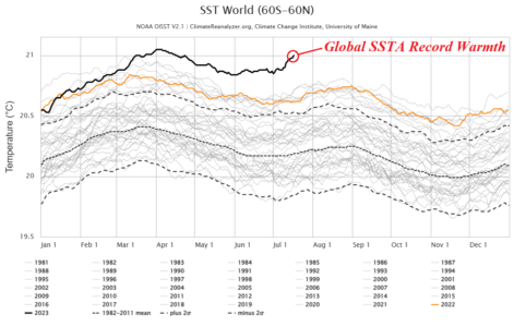
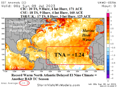
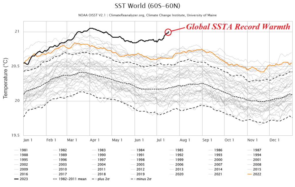
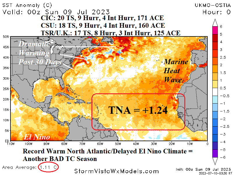
Increasing attention is given to the recent uptick to large regions of oceanic warming outside of the tropical region. Marine heat waves are present across much of the middle/subtropical latitudes in both hemispheres causing a record warm ocean surface according to the Climate Change Institute at the University of Maine. Certainly, the evolution of an increasingly bold El Nino and recent near onset of positive phase Indian Ocean dipole has helped. The oceanic warming in the middle latitudes has caused warming aloft to increase high-pressure ridging to deliver hot weather to populated land masses for mid-summer in the northern hemisphere.