News
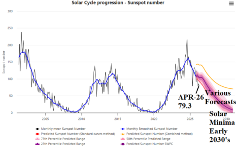
05/12/2026, 1:54 pm EDT

Super El Nino Increasingly Likely. Where are the First (climate) Targets?

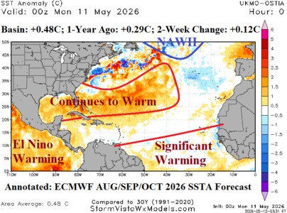
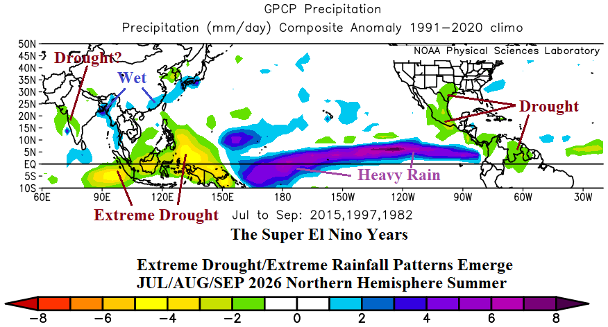
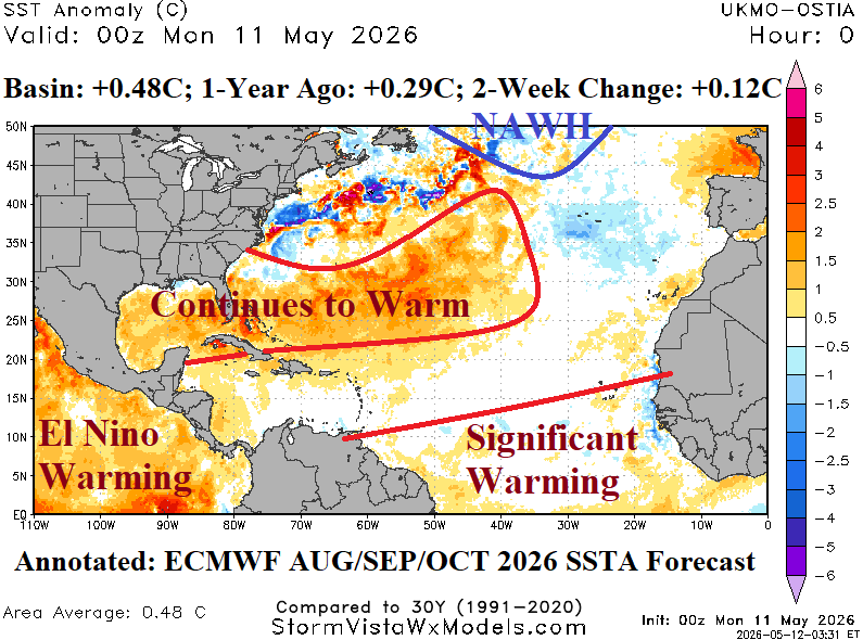
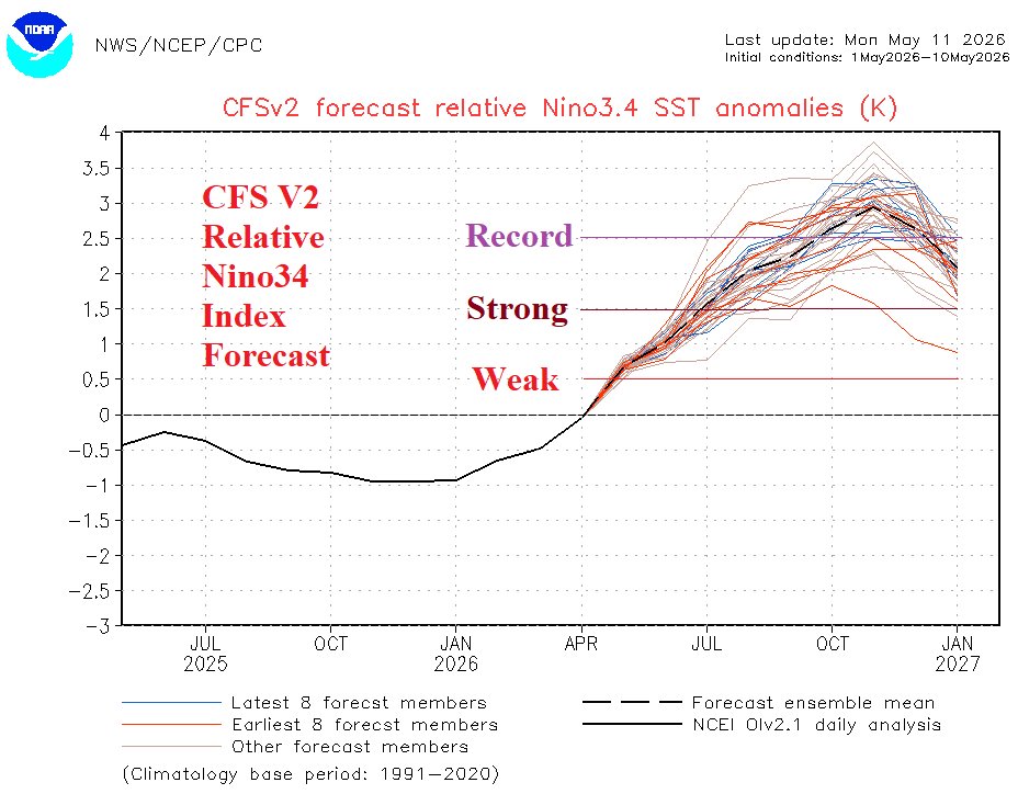
Super El Nino climate is on the way following the equatorial East Pacific warming of the next several months when, beginning in JUL/AUG/SEP, the northern hemisphere tropical/subtropical latitudes are highly impacted by this phenomenon. Most striking is the likely extreme drought for Indonesia. As impressive is the streak of heavy rain across the central and east tropical Pacific Ocean likely to fuel an intense East Pacific tropical cyclone season.
05/12/2026, 9:34 am EDT

Decelerating Solar Intensity

Solar Cycle 25 has passed peak and is now decelerating in intensity which will continue into solar minimum beginning in 2030. Once solar minimum is reached, solar cycle 26 begins. The APR-26 sunspot number was 79.3 and weaker than various forecast model projections.
05/12/2026, 9:24 am EDT

North America SSTA: Western Subtropics and Deep Tropics Significant Warming Ahead

As mid-May approaches, just a few weeks before onset of tropical cyclone season, the North Atlantic basin is moderately warm (+0.48C) which is about 0.2C warmer than one year ago and generally cooler than basin SSTA for this time of year during the past decade. The warm regions are the Gulf of Mexico (basin average +0.88C) and eastward across the Bahamas to southeast of Bermuda. Other areas are cooler than normal, especially off the Mid-Atlantic Coast and southwest of Portugal. The North Atlantic warm hole (NAHW) south of Greenland is developing.
05/11/2026, 12:33 pm EDT

Upper Ocean Heat East of Dateline 2nd Warmest Historically

Upper ocean heat index is between +2 and +2.5 for the past 3-4 weeks which is warmest on record for El Nino events EXCEPT for the 1997 episode. Potential energy for El Nino development and intensification is immense.