06/11/2025, 4:44 am EDT
A map of europe with orange and yellow spots AI-generated content may be incorrect.

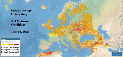
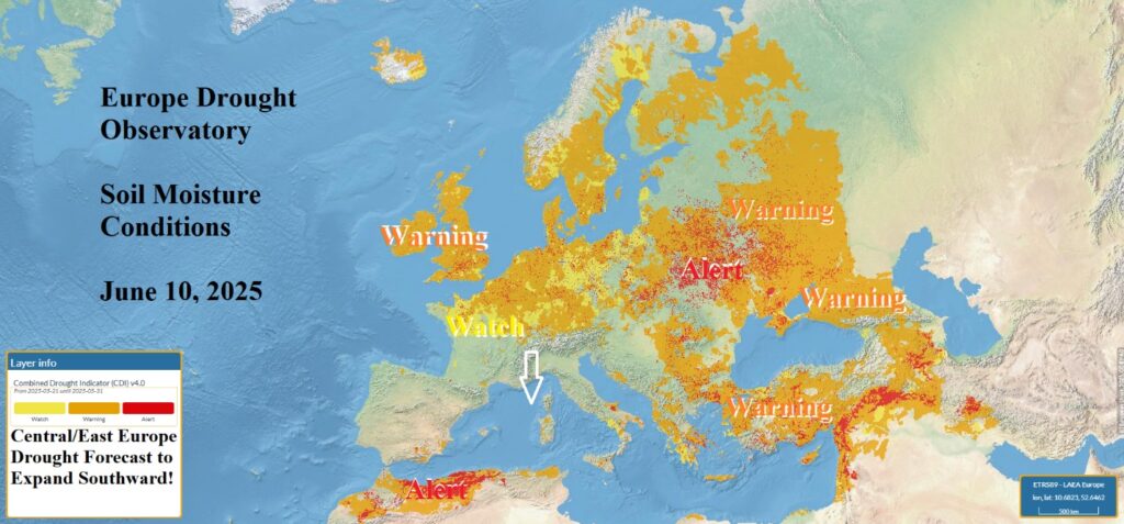
Hot and Dry Pattern Ahead for Europe; Drought Expansion Southward!

Marine heatwaves off Southwest Europe and in the Mediterranean Sea foreshadow amplified subtropical high-pressure ridging ahead as forecast for the remainder of June in Europe. The attendant weather is dry and hot and causes drought in Europe to strengthen and expand southward.
06/10/2025, 10:51 am EDT
A map of the earth with different colors AI-generated content may be incorrect.

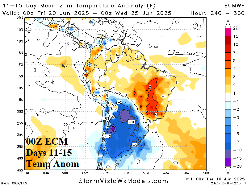
Freeze Risk Southern Brazil Days 11-15 On The Table

ECM has introduced a chilly burst across Argentina extending to Southern Brazil in the 11-15-day period. However, the GFS was completely disagreeable rendering a much warmer solution. The following GFS model run shows the cooler result. Therefore, forecast confidence on potential important cold is on the table for the 11-15-day period.
06/09/2025, 3:37 pm EDT
A map of the united states AI-generated content may be incorrect.

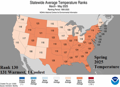
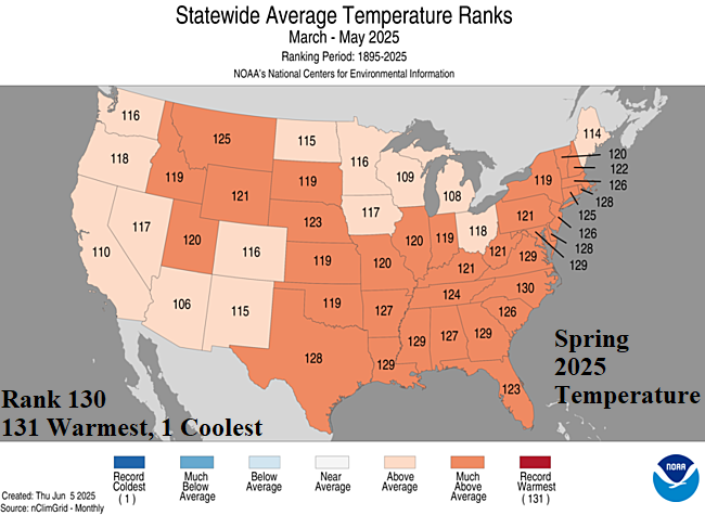
Second Warmest Meteorological Spring on Record in U.S.

Meteorological spring 2025 was the second warmest on record. Thirty-three states observed MUCH ABOVE normal temperature with 12 states recording an all-time top 5 warmest springtime on record. North Carolina finished 2nd warmest on record.
06/09/2025, 4:43 am EDT
A map of the world with green and orange colors AI-generated content may be incorrect.

Persistent -GLAAM = Wetter Than Normal Northern Hemisphere Climate Pattern

-GLAAM has been common since the middle of last February. -GLAAM is present when mid-latitude jet stream flow is slower than normal increasing the risk of longwave trough presence and attendant storminess. Interestingly, the persistent -GLAAM produced widespread wet soil moisture changes around the northern hemisphere during meteorological spring.
06/09/2025, 4:00 am EDT
A map of the united states AI-generated content may be incorrect.

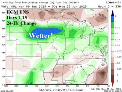
Shifting Wetter U.S. Corn Belt in Medium-range Forecasts

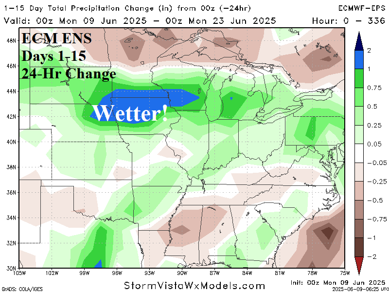
Climate forecasts indicate drier/hotter risk shifting into the Midwest U.S. later in this summer. Late last week, forecast models suggested a possible onset of this warmer/drier pattern change for the 8-14/11-15-day period. However, over the weekend, forecast models trend wetter/cooler for the Midwest States.
06/06/2025, 1:52 pm EDT
A map of the world with green and orange colors AI-generated content may be incorrect.

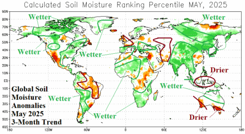
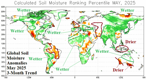
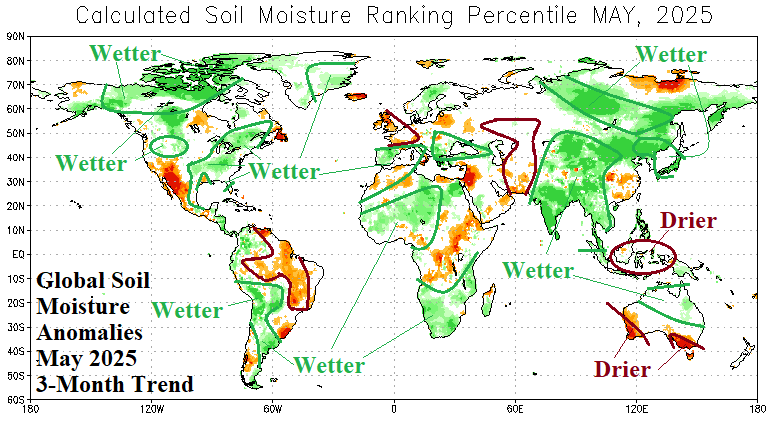
Wetter Changes to Global Soil Moisture in May 2025

Global soil moisture trend during the past 3 months was overwhelmingly much wetter on each continent. Most notable was the expansion of wet soils across East and South Asia especially India. A much wetter change was observed across Japan. In Australia, the southwest and southeast corner were drier while the remainder of the Australian East Coast to northern areas were much wetter.
06/06/2025, 7:20 am EDT
A map of the united states with weather AI-generated content may be incorrect.

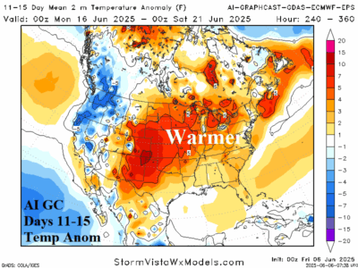
Evolution of Midwest Heat Projected Extended-range

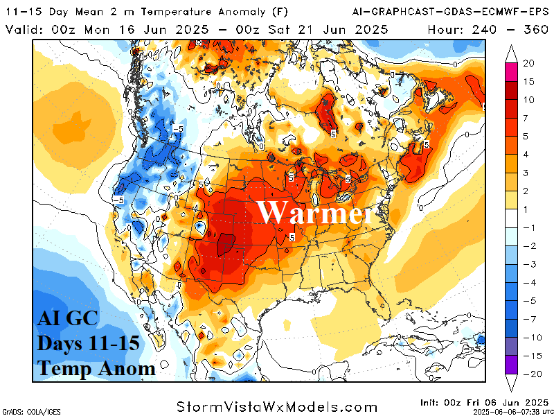
In the extended range, AI Graph Cast and to a certain extent ECM ENS, are shifting West U.S. heat into the Central U.S. In the 16-20-day forecast, the anomalous heat crests over the Midwest States. Both NOAA and Climate Impact Company indicate dry/hot weather for this zone during JUL/AUG/SEP. Is this the onset of that pattern?
06/05/2025, 9:18 am EDT
A map of the united states AI-generated content may be incorrect.

ECMWF “Monthlies” Aggressive with Dry/Hot Climate Central/Northern Great Plains JUL/AUG/SEP

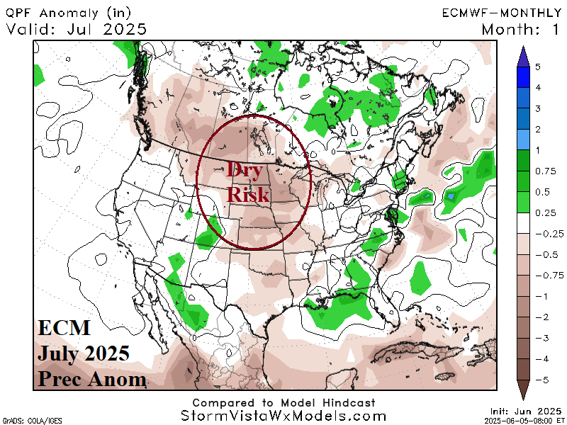
The just-issued ECMWF “monthlies” aggressively forecasts consistent anomalous dry and hot climate across the central and northern Great Plains and much of the Canadian Prairies for July through September. The model shifts wet weather risk to the East Coast and Gulf of Mexico Coast leaving high pressure across the North-central States. The high-pressure location is also inspired by a tendency for monsoon thunderstorm activity across the Southwest U.S.  
06/05/2025, 5:53 am EDT
A map of weather forecast AI-generated content may be incorrect.

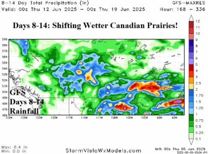
Possible Wetter Changes Ahead in Canada

Currently, warnings for ongoing brush/forest fires are issued for most of South-central to East-central Canada. The hazard has increased dramatically this week. However, wet weather appears early in the 6-10-day period across the western Canadian prairies. In the 8-14-day period, all models indicate potentially substantial rainfall for much of the Canadian Prairies and the remainder of Southern Canada.
06/05/2025, 4:56 am EDT
A graph of the weather forecast AI-generated content may be incorrect.

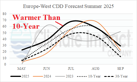
Europe Summer 2025 CDD Forecasts are Very Warm!

May 2025 CDD count was an over-achiever for Europe Western Cities. The consensus of selected West Europe cities CDD in May was MUCH ABOVE normal and inspired by Heathrow and Paris-Orly with warmest departures. The warm signature appears in the June and July forecast for Western Europe as the consensus of selected cities is much warmer than the 10-year normal and except for JUN-23 is the warmest of the past 3 years.
06/03/2025, 9:03 am EDT
A graph of the temperature of the north atlantic tropics AI-generated content may be incorrect.

Upper Ocean Heat North Atlantic Tropics on June 1st

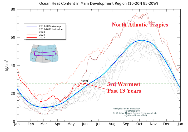
As the 2025 North Atlantic basin tropical cyclone season begins, a review of where we stand regarding upper ocean heat across various basins in the North Atlantic where tropical cyclones form and travel. In the tropical North Atlantic, upper ocean heat is above the 2013-24 normal and tied for 3rd warmest in the 13-year climatology. If warming (compared to normal) occurs during the summer months, hurricanes will be in the upper limit of 6-10 forecast by NOAA for the 2025 season.