News
01/04/2024, 4:41 am EST

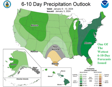
Highest Precipitation Probability for Days 6-10 Issued by NOAA/CPC in Memory

Yesterday's NOAA/CPC precipitation probability forecast for the East U.S. is the wettest in memory. Interestingly, Graph Cast AI emphasizes heavy to extreme rain (and wind) in the East during the 6-10-day timeframe while GFS and especially ECM are focused on incoming frigid arctic air in the West. Wild weather ahead in the U.S.
01/03/2024, 12:44 pm EST

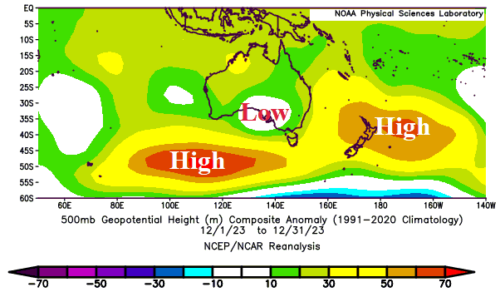
Marine Heatwaves And East Australia Heavy Rains

Emergence of a marine heat wave (MHW) east of Australia extending to the east of New Zealand coupled with another elongated MHW across the central and southeast Indian Ocean are well-correlated to high pressure ridge areas. In-between the ridge areas, a low-pressure area has spawned over the central coast of South Australia. The upper trough combined with the warmer SSTA off the East Coast is causing excessive rainfall in Eastern Australia so far during meteorological summer 2023-24.
01/03/2024, 12:37 pm EST

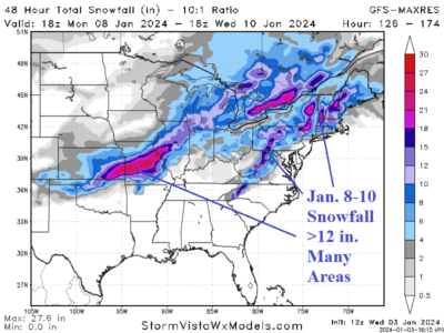
Several Snowstorms Ahead in the East U.S.

The 12Z GFS piles snow via 4 storms (three are pictured) across the Northeast, Midwest, and South-central U.S. The snow in the East should encourage colder weather. Consequently, the warmer East U.S. midday 12Z GFS may be too warm.
01/03/2024, 5:14 am EST

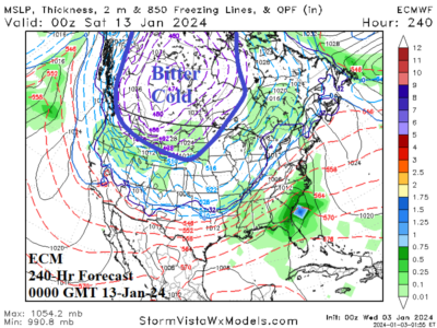
Warning…ECM Indicates Bitter Cold in 10 Days!

The overnight ECM 240-hour forecast is an attention getter. Frigid arctic air is present across the western half of Canada charging into the Northwest and North-central U.S. Temperatures average 20F to 40F below normal in this air mass and feature 2-meter temperature forecasts of -40F to -50F in Central Canada with below zero into Wyoming and South Dakota.