News
09/04/2025, 5:08 am EDT
A map of the world AI-generated content may be incorrect.

AG Market Hot Spot: South America Update

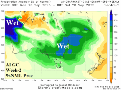
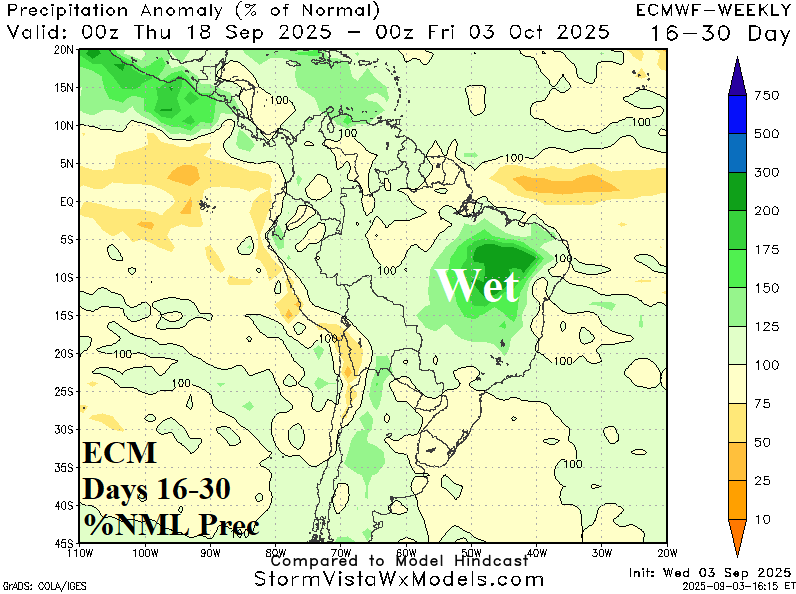
The best analog suggests that a developing weak La Nina favors ongoing dryness in Brazil during spring reversing wetter once summer arrives. Implied is the torrid Brazil drought worsens during spring with some relief into the new year. In the short-term, dry weather prevails in Brazil through 10 days. However, models are indicating a wetter change for the 11-15-day period carrying into the 16-30-day timeframe.
09/04/2025, 5:03 am EDT
A diagram of the weather AI-generated content may be incorrect.

Subsurface Equatorial Upper Ocean Heat Anomalies Dictate IOD/ENSO Ahead

The subsurface equatorial upper ocean heat profile foreshadows phase change of various modes of climate variability. In the Indian Ocean, the eastern portion of the equatorial region has warmed significantly (Fig. 1). Implied is evolution of a potentially strong negative phase of the Indian Ocean dipole (-IOD). The daily IOD index is robust -1.04. The -IOD regime has arrived. In the equatorial Pacific, the eastern portion has cooled significantly. Implied is an approaching La Nina episode.
09/03/2025, 1:28 pm EDT
A map of the united states with red and blue lines AI-generated content may be incorrect.

NOAA September Wildland Fires: Rare New England Risk, Widespread California Risk, and All Hawaii Risk

NOAA reissues their significant wildland fire potential outlook for September and October. Not surprising is the rapid risk increase for many parts of Central and Southern California plus all Northern California. The above average risk extends to Northern Nevada and Southwest Idaho. Added is the western portion of Washington. Wildland fire potential risk is above average near many major city and town locations for Western Washington and California.
09/03/2025, 6:02 am EDT
A map of weather forecast AI-generated content may be incorrect.

-IOD/La Nina Inspired Wet Climate Ahead for Australia

The Indian Ocean Dipole has shifted to negative phase and a borderline La Nina is developing. The last time -IOD and La Nina were present during SEP/OCT was in 2022 when buckets of rain fell on the East/Southeast! Be aware of potential over-achieving rains in the East for spring 2025! The AI Graph Cast week 2-4 outlook reveals the upcoming wet pattern for East Australia.