06/10/2024, 5:44 am EDT
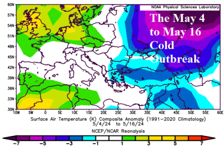
Europe and Western Russia are the target of extreme weather and climate conditions through the spring season. On May 7, Moscow declared a state of emergency for crop conditions due to damage suffered during many freeze events occurring in early-to-mid May. Not helping is the long-term lack of precipitation in the Eastern Black Sea region throughout Southwest Russia. Conversely, much of Europe is soaking wet since March 1.