News
08/19/2025, 3:54 pm EDT
A map of the weather AI-generated content may be incorrect.

Expecting TC Activity Each of the Next 4 Weeks

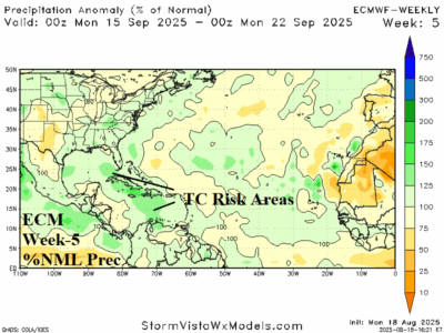
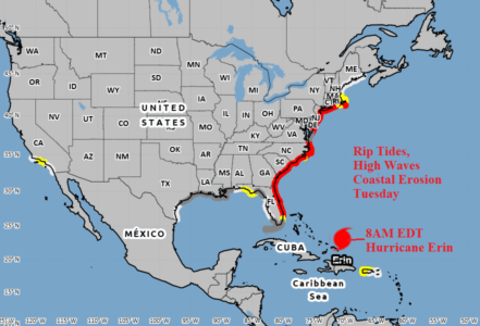
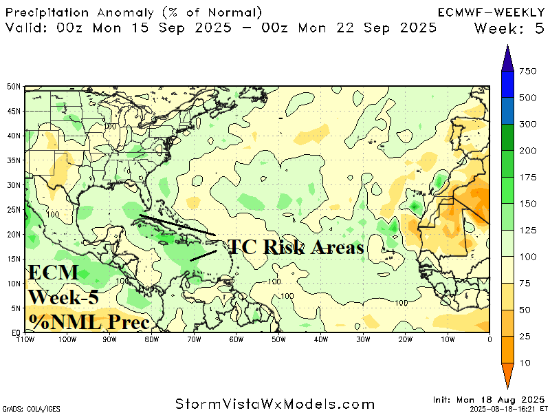
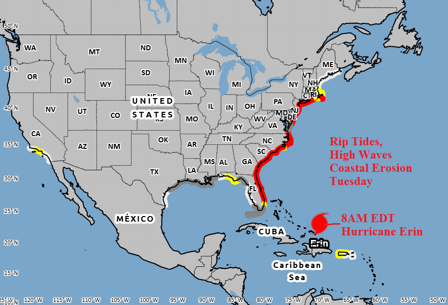
The tropics become busier producing a tropical cyclone risk each of the next 4 weeks including more than one event in at least 2 of 4 weeks. The Gulf of Mexico should become more active during the period. Peak of season is around September 10th!
08/19/2025, 12:26 pm EDT
A map of the united states AI-generated content may be incorrect.

Explaining Why “Weeklies” Performed Temperature Forecasts Poorly During Summer 2025

Climate Impact Company offers explanation for why North America 16-30-day (week-3/week-4) temperature forecasts have routinely produced very warm bias. Unusual presence and persistence of a summertime Northeast Canada polar vortex and convection phase Madden Julian oscillation (MJO) stretched across the tropical Pacific Ocean are the culprits significantly contributing to East U.S. heat and occasional historic rainfall events.
08/18/2025, 9:25 am EDT
A map of the united states AI-generated content may be incorrect.

East Coast Impacts Due to Hurricane Erin

Primary impacts on the U.S. East Coast by Hurricane Erin are riptides beginning today and becoming widespread on Tuesday. In the riptide area, increasing and/or high waves and onset of beach erosion is likely. The conditions which become widespread tomorrow will continue through Thursday. The onset of tropical storm force wind is Wednesday for coastal North Carolina and possibly Nantucket and Martha’s Vineyard on Thursday.
08/18/2025, 5:03 am EDT
A map of the united states AI-generated content may be incorrect.

August 2025 U.S. Soil Moisture Observations/Outlook

The U.S. soil moisture observations and trend reveal ongoing and worsening West/Southwest U.S. drought and adding Northeast U.S. dryness which is (also) strengthening. The southern Canadian Prairies to the Midwest States and Carolinas are the wet zones.