News
06/30/2024, 8:40 am EDT

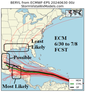
ECM Is Model of Choice, Sweeps Beryl Due Westward!

ECM appears to have the best handle on the long-range forecast track of Beryl keeping the system moving westward south of the powerful subtropical ridge to the north. The NOAA/NHC 5-day forecast has shifted the 4-5-day track farther south into the central Yucatan Peninsula Thursday night.
06/28/2024, 9:10 am EDT

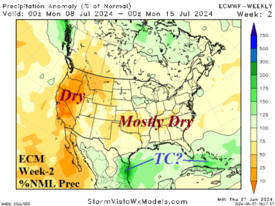
Hot and Dry Combination Accelerates Drought Risk West and East U.S.

Due to rapid drying of soils in the East U.S., NOAA/CPC issues a statement on the likelihood of rapidly developing drought in the East U.S. due to limited rainfall and the acceleration of soil moisture drying by anomalous heat. A similar scenario for the western states!
06/28/2024, 9:02 am EDT

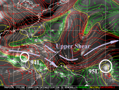
Moderate Upper Shear Monitored, Possibly Inhibiting 95L Development

Identifying the location and intensity of the upper shear axis is the first consideration when the tropics turn busy and tropical cyclone models project intensifying events. Of course, Tropical Disturbance 95L is the primary issue. The immediate environment is favorable for development of 95L to a tropical cyclone withing 24-48 hours due to light shear and 83-84F SST. However, a moderate shear axis extends into the Caribbean Sea with a second axis well northwest of 95L.
06/27/2024, 9:55 am EDT

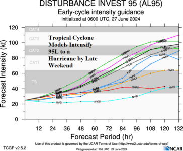
Tropical Cyclone Models Develop 95L to a Hurricane

Tropical cyclone models offer the first intimidating outlook of the 2024 season in the North Atlantic basin by indicating Tropical Disturbance 95L currently located in the outer tropical North Atlantic intensifies to a hurricane by late weekend and possibly a major hurricane in 5 days.