During the past 60 days, the NOAA AI Eagle has performed well forecasting the weather pattern (500 MB anomalies) across the northern hemisphere during the 6-10-day/11-15-day medium range forecast.
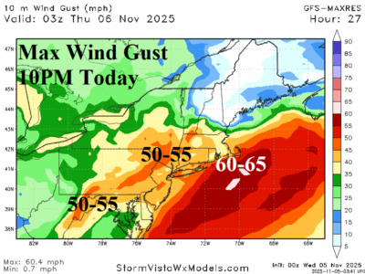
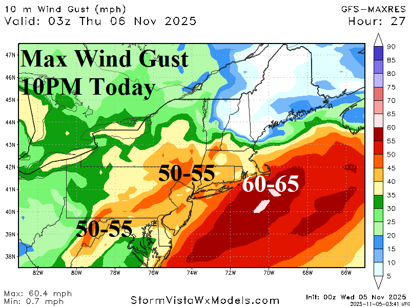
Peak wind gusts are near 50 mph this morning across the Ohio Valley increasing to 50-55 mph this evening across the central/northern Appalachian Mountains toward NYC and New Jersey and roaring past South/East New England with gusts to 65 mph possible late tonight. NYC, Hartford, Boston and across Cape Cod could see significant power outages!
The North America snow cover lagged below normal during mid-autumn thanks to a warm Canadian climate while advection snows across the open water north of Eurasia during October allowed snow cover to build above normal during mid-autumn for the 15th straight year.
Generally, sudden stratospheric warming (SSW) events capable of producing arctic outbreaks are considered more likely during easterly phase of the quasi-biennial oscillation (-QBO). Past winter seasons when -QBO was developing in November, similar with 2025, and peaking during the winter season, similar with winter 2025-26 expectation, are identified (since 1979).