08/20/2024, 8:42 am EDT

August 2024 Marine Heatwave Report

The end of July 2024 global marine heatwave assessment from NOAA indicated that 35% of the oceans are in marine heat wave status. The monthly observation ranks 14th highest in the nearly 400 months of observations dating back to 1991. NOAA indicates MHW coverage of 35% now will decrease to about 30% by October 2024.
08/19/2024, 8:45 am EDT

Madden Julian Oscillation Reactivates; Suppresses North Atlantic Tropics

After a month-long dormant period, the Madden Julian oscillation (MJO) has reactivated over the tropical Indian Ocean. The 15-day forecast utilizing all operational models indicates MJO will move east to Maritime Continent over the next 15 days. The MJO enhances convection, certainly evident in the tropical Indian Ocean and surrounding areas (Africa, India, and Western Indonesia) now where heavy rain is occurring.
08/19/2024, 8:31 am EDT

The 2024 Tropical Cyclone Activity Is Lagging The Analogs

The tropical cyclone activity for 2024 so far is slightly above normal for the date. However, unfolding (and likely to continue) is the seasonal activity amount lagging well behind the analog years used to generate the 2024 tropical cyclone season forecast.
08/18/2024, 12:02 pm EDT

Remains of Ernesto Gust Across Ireland/U.K. Thursday

A brief period of damaging high wind associated with former Hurricane Ernesto is forecast to streak across Ireland and U.K. during the daytime hours on Thursday featuring potential for hurricane force gusts.
08/18/2024, 9:39 am EDT

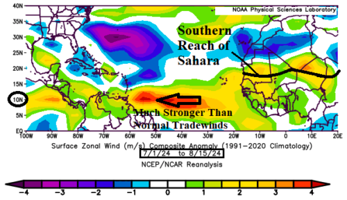
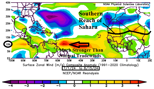
Fast Trade Winds Preventing Very Active North Atlantic TC Regime

Faster than normal trade winds are normally associated with a temperature inversion usually around 850 MB (about 1,500 meters). The temperature inversion prevents vertical motion enabling convective cloud formation associated with developing tropical disturbances. Since July 1st, trade winds have been much faster than normal across the North Atlantic tropics.
08/15/2024, 10:32 am EDT

NOAA Long-lead Climate Forecasts; CIC Comparisons and SEP/OCT/NOV High Impact Climate

A comparison between the Climate Impact Company constructed analog and NOAA/CPC probabilistic forecast for meteorological winter 2023-24 is, not surprisingly, reasonably similar. NOAA/CPC expands drought in the West-central/Central U.S. this autumn season. The Southeast/East Coast are at risk of tropical cyclone strikes the next couple months.
08/15/2024, 5:05 am EDT

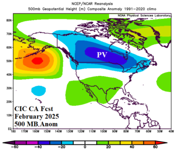
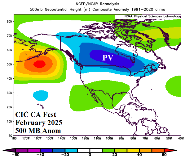
North America Winter 2024-25 Can Expect a “Polar Vortex” in February

Based on a constructed analog combining optimum climate normal and ENSO analog years the upper air pattern for North America for each month of meteorological winter 2024-25 is projected. Revealed is low risk of a “polar vortex” pattern during December or January. However, a broad polar vortex pattern is forecast across Southern Canada during February.
08/14/2024, 11:47 am EDT

Dramatic Uptick in Tropical Activity Late August into Mid-September

The North Atlantic basin is becoming ripe for a sudden uptick in tropical cyclone activity after Ernesto. ECMWF indicates many ALERTS for tropical cyclone development for later in August to mid-September. During this time, several to as many as 5 hurricanes may emerge.
08/14/2024, 4:45 am EDT

Heavy Rain Episode Departing Australia East Coast

Extreme rain has been produced by an unusual weather system on the East Coast of Australia during the past 1-2 days. An elongated cold front stretching northward from a polar vortex south of New Zealand joined forces with an inverted subtropical low-pressure trough off the Queensland Coast to produce an excessive rainfall event affecting Coastal Queensland and Coastal New South Wales.
08/13/2024, 8:42 pm EDT

Europe Summer 2024 CDD’s…Staying Very Warm East

Verification for July 2024 CDD for selected Europe cities were, on average, warmer than forecast. The strongest (warm) anomalies were in Vienna and Milan although Paris, Berlin, and Munich were each moderately warmer than normal. The Europe-East forecast maintains the warmer than normal signature.
08/13/2024, 8:10 am EDT

The Norwegian Sea Marine Heatwave

The latest Europe/Russia week 2-4 outlook begins with a look at a gigantic marine heatwave centered on the Norwegian Sea and extending northward. By far, the strongest anomalous warming in this region on record and well-correlated to an upper-level high pressure ridge.
08/12/2024, 10:46 am EDT

Why Is La Nina Not Developing?

La Nina trajectories for later 2024 are not developing yet. The southern oscillation index is stubbornly in an El Nino phase so far in August after marginal El Nino-like observations in July and June. The problem is surface pressure in the tropical East Pacific is not rising sufficiently and surface pressure in the far western Pacific tropics remains at normal level rather than lowering typical of La Nina.