03/10/2025, 8:28 am EDT

High Wind Event Great Plains to Midwest Late Week and Early Next Week

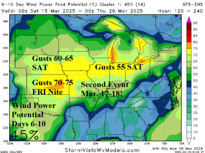
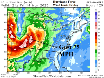
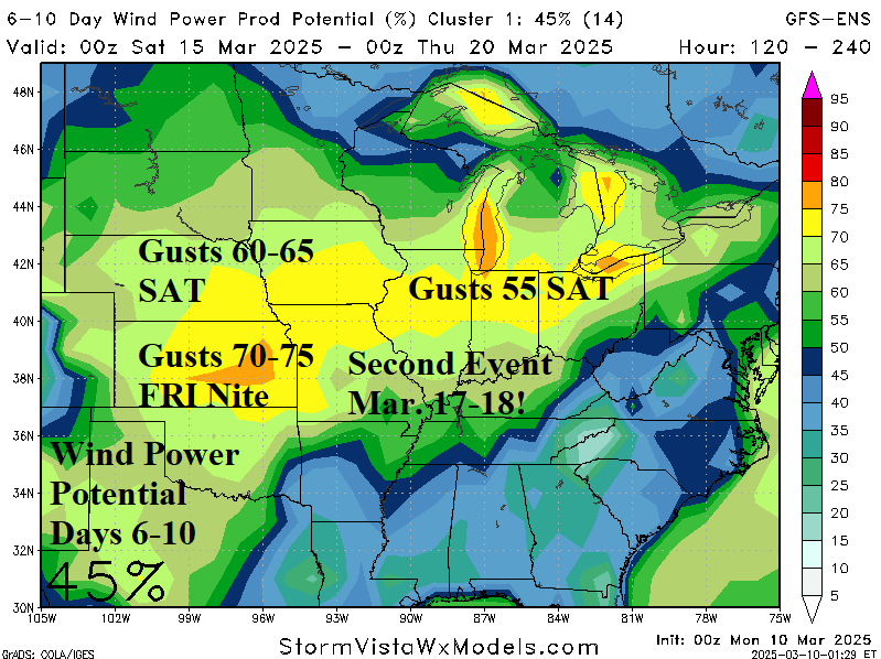
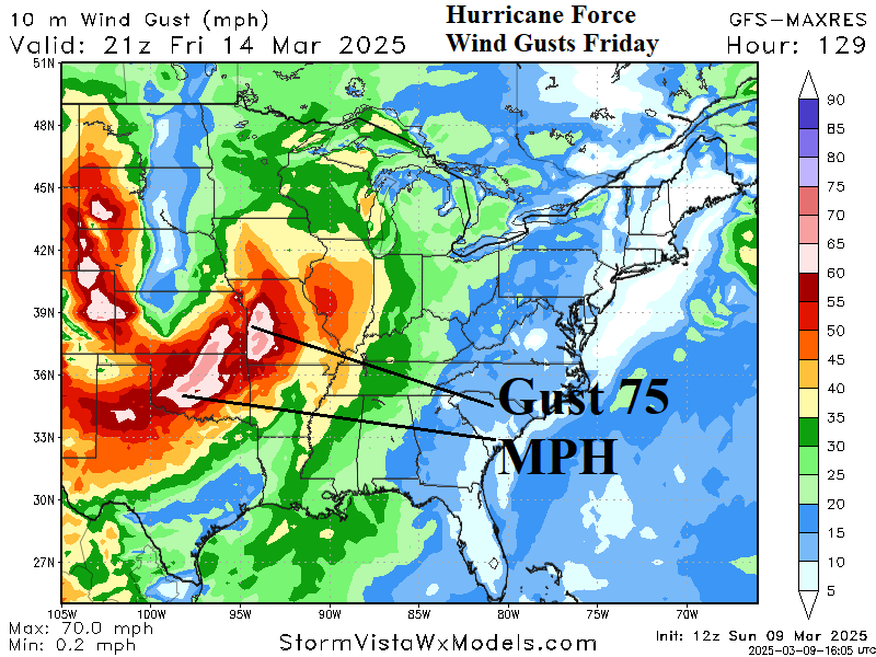
An unusually strong wind event begins Friday across the southwest Great Plains and Texas shifting to Kansas Friday night. Hurricane force wind is widespread with this event. The high wind event shifts to Nebraska and the Northern Ohio Valley next Saturday. Another high wind event with similar intensity in the same location is forecast early next week.
03/09/2025, 2:35 pm EDT

High Impact/High Windstorm Later This Week Great Plains

Featured next Friday is an unusually low pressure of 970 MB centered on Nebraska. The low pressure causes a large area of extreme wind including sustained wind of 30-50 mph across much of the Great Plains with wind gust potential easily exceeding hurricane force.
03/07/2025, 8:51 am EST

Extreme Rain/Severe Weather Event Late Next Week Mid-south U.S.

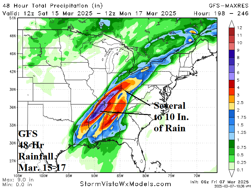
Next week, 2 major storms are forecast across the eastern half of the U.S. featuring 4-8 inches of snow with high wind creating blizzard conditions across the North-central U.S. and a flooding rain/severe weather outbreak for the Mid-south States both events late next week into the weekend.
03/06/2025, 1:45 pm EST

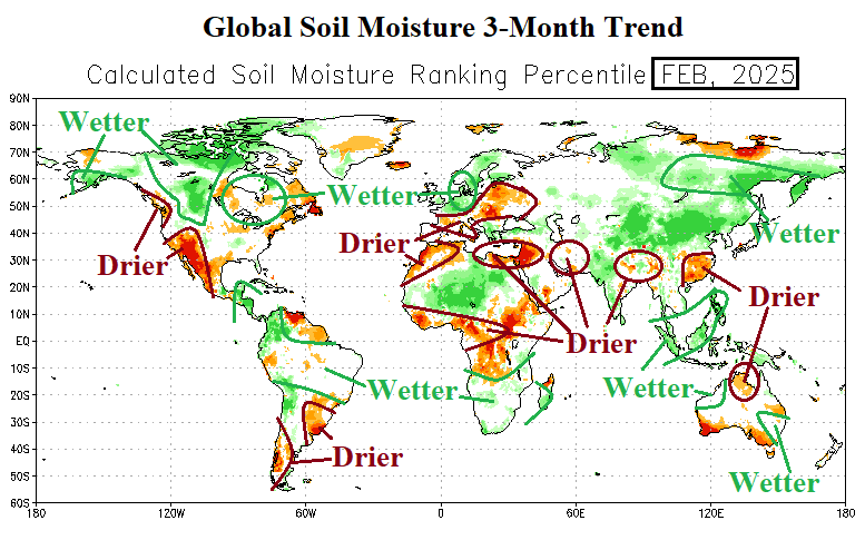
Global Soil Moisture Observation Trend/Forecast

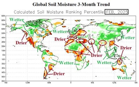
Major drought is developing and will intensify in the Southwest U.S. and Middle East plus East China and West Tropical Africa based on the most recent Climate Impact Company 3-month global soil moisture outlook.
03/05/2025, 8:27 am EST

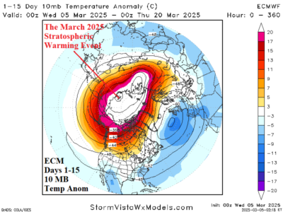
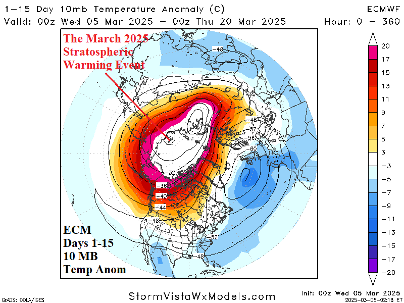
Update on the Stratosphere: Comparing MAR-25 Event with JAN-25/FEB-25 Episodes

The U.S. arctic outbreaks in January and February were triggered by unconventional stratospheric warming events in that the warming was confined to Canada and the attendant polar vortex was locally generated, over North-central U.S. to cause the cold. Note that the stratosphere was cold on the Europe side of the North Pole. The March stratospheric warming event is stronger and across wider aerial coverage. However, the core of the warming is on the Siberia side of the North Pole therefore less reliably effective at generating North America cold.
03/04/2025, 5:21 am EST

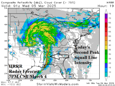
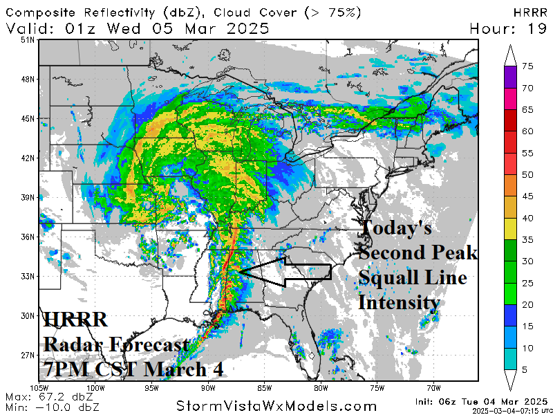
Major Severe Weather Outbreak South-central and East U.S. Next 2 Days

A major severe weather outbreak is forecast for today across northern Gulf States and Mid-south U.S. A large area is forecast to receive tornado risk from Texarkana to Mobile today/tonight. On Wednesday, the severe weather risk shift is into the East. Tornado risk continues centered on the eastern Carolinas and southeast Virginia.
03/03/2025, 4:24 pm EST

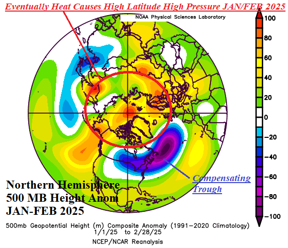
Why Was JAN/FEB 2025 Colder than Expected?

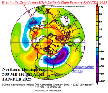
Of course, the explanation is complex. But, in my view, a large contribution to the unexpected cold pattern occurring mid-to-late meteorological winter across the U.S. was caused by the poleward latent heat release (caused by seasonality) across the record warm northern hemisphere oceans last mid-to-late autumn.
03/03/2025, 1:04 pm EST

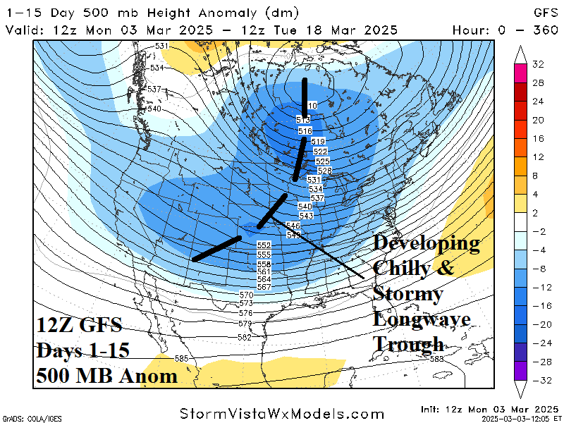
Stratospheric Warming FINALLY Produces Colder Model Run

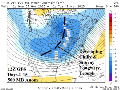
Today’s 12Z GFS forecast is the first to show a sprawling colder and stormy look since stratospheric warming conditions were in the forecast. At midday, the 12Z GFS reveals an evolving central North America longwave trough. The polar vortex shifts from the coast of Northeast Canada to Hudson Bay.
03/03/2025, 12:59 pm EST

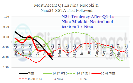
La Nina Modoki Analogs

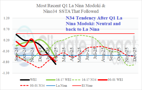
A rarely observed La Nina Modoki has developed in the central equatorial Pacific Ocean. Climate Impact Company identifies Modoki using the ENSO West-East Inex (WEI) which simply compares SSTA in the Nino4 region near the Dateline and the Nino3 region in the eastern equatorial Pacific away from the moderating effects on SSTA caused by proximity to land off the northwest coast of South America (where the Nino12 SSTA region is located). The La Nina Modoki index is -0.9C for the month of February and the daily index has jumped to -1.23C.