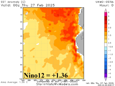
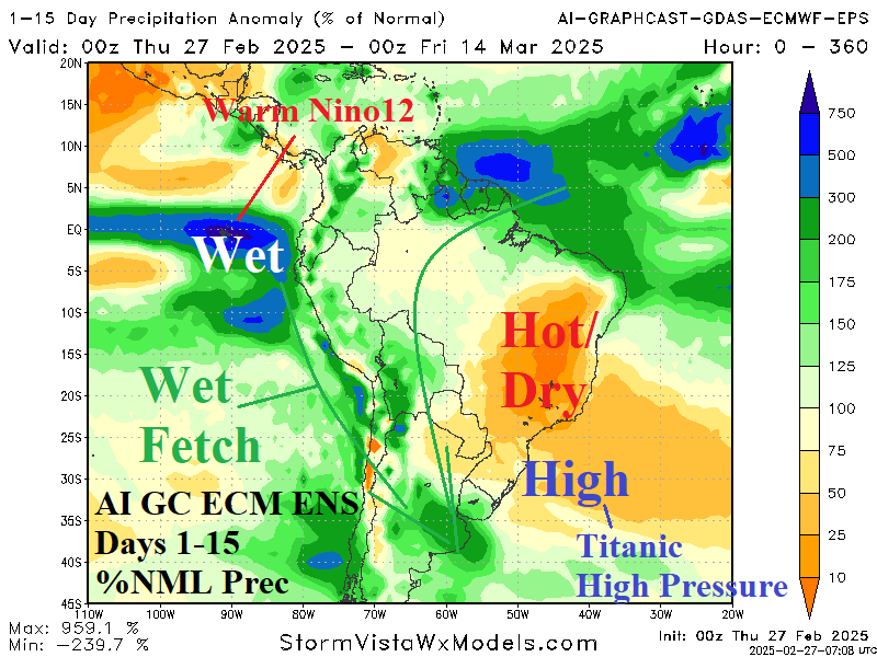
The daily Nino12 SSTA roars to +1.36C and is nearly 2C warmer than 30 days ago. The 2024-45 La Nina appears short-lived! The much warmer change is driven by effects from a recent Madden Julian oscillation regime.
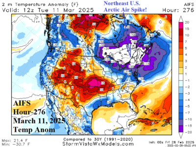
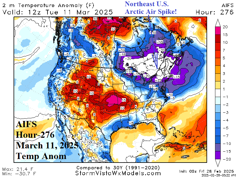
Stratospheric warming is indicated in the polar region in the 11-15-day period. The warming is immense and should cause arctic air to form at ground level. Forecast models are slow to identify the arctic air risk. What may happen is "chunks" of arctic air form and bring brief but potent cold as indicated by AIFS into the Northeast U.S. centered on March 11.
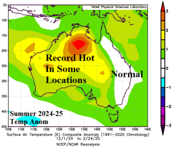
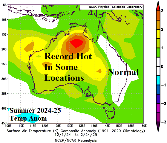
Interestingly, the 500 MB anomaly pattern governing the Australia summer 2024-25 pattern was the polar opposite of the 2015-25 optimum climate normal. Marine heat waves once again played a large role in the Australia summer weather pattern and will continue to guide climate patterns through autumn as ENSO influence weakens with fading La Nina.
Titanic subtropical high pressure leads to the hottest weather of calendar summer in East Brazil and much of Australia into early March. Nearby heavy rains are in Argentina while a major tropical cyclone is close to the Australia East Coast.
