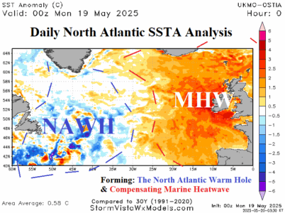
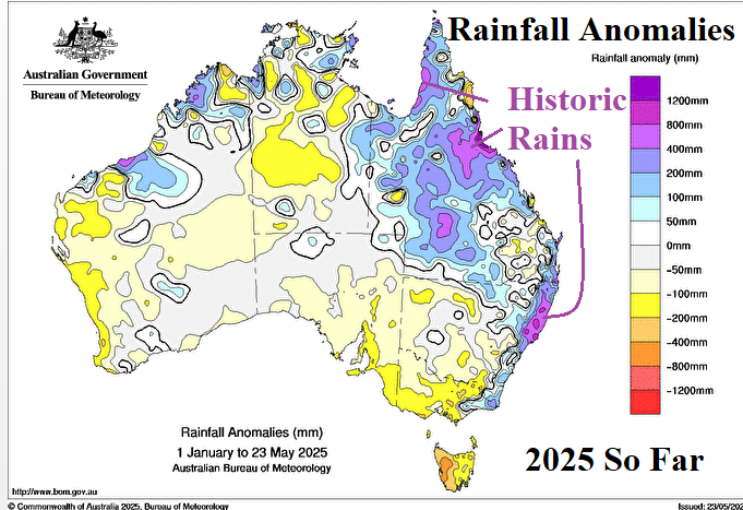
A large increase in MHW’s during the past decade appears to be a leading contributor to global ocean temperature rise and Australia is a location directly affected by the attendant climate produced by MHW’s.
A chilly outbreak remains in the 11-15-day forecast across Argentina into Southwest Brazil as meteorological winter 2025 arrives. There is marginal <32F/<0C risk in northeast Argentina with the season's first cool burst. The intensity of this potential event may be a guide on additional cold risk as wintertime arrives in South America.
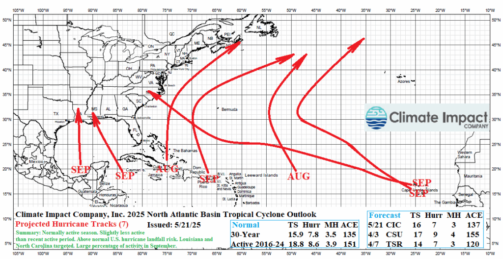
The updated Climate Impact Company 2025 North Atlantic basin tropical cyclone season forecast projects 16 tropical storms, 7 hurricanes, and 3 intense hurricanes. The accumulative cyclone energy (ACE) index forecast is 137. The outlook is slightly less active than the original outlook issued 2 months ago.
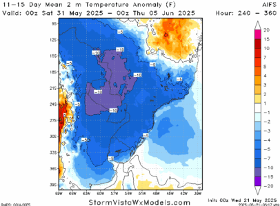
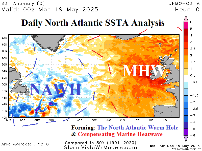
The mid-latitude mid-to-late May 2025 upper-level low-pressure troughs, most prominent across the East U.S., are the result of high latitude high pressure blocking (also) causing unusually warm surface temperatures which are accelerating polar ice melt including the Greenland icesheet. The freshwater runoff is creating a stratified cool layer of water at the surface south of Greenland as the North Atlantic warm hole (NAWH) is developing.

