01/07/2025, 8:34 am EST

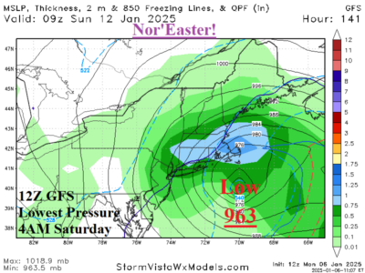
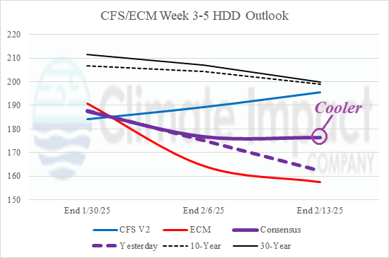
The U.S. gas population weight HDD forecast stays cold with high national heating demand through next week. The outlook is moderately cold Jan. 17-23 and the extended range for February is much warmer due to an expected mild month in the East.