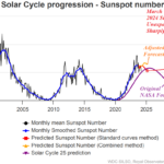
Suddenly, Sunspot Number Lowers Dramatically in March
04/08/2024, 10:33 am EDT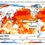
Will Evolution of +IOD Interrupt La Nina 2024 Expectations?
04/11/2024, 9:16 am EDT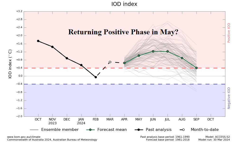
Charts of the day: Conflicting IOD forecasts.
Fig. 1: The Australia Bureau of Meteorology is forecasting a regenerating positive phase of the Indian Ocean dipole by MAY/JUN 2024.
Discussion: An interesting conflict has emerged regarding phase of Indian Ocean dipole (IOD) for mid-2024. The Australia Bureau of Meteorology indicates a shift of the neutral IOD pattern back into positive phase by MAY/JUN (Fig. 1). The positive phase remains in-place through the winter season. The Climate Impact Company constructed analog forecast maintains neutral phase (Fig. 2). During 2024, La Nina is forecast to develop. However, +IOD occurring with La Nina is unusual. +IOD events are favorable when El Nino is present. Interestingly, some dynamic models (ECMWF) are downplaying La Nina in 2024 which favors development of +IOD. The +IOD regime favors a drier than normal climate pattern across much of Australia (Fig. 3).
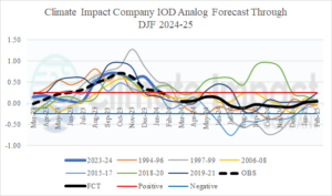
Fig. 2: The Climate Impact Company constructed analog forecast indicates neutral IOD for 2024.
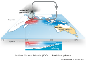
Fig. 3: Climatology of +IOD episodes indicate reduced chance of precipitation across much of Australia.
Week-2 Ahead Forecast valid April 14-20, 2024: Forecast trend is wetter Northeast/East Australia.
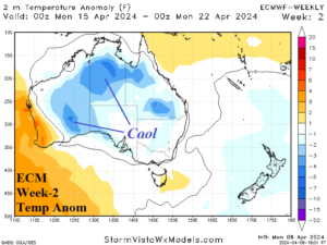
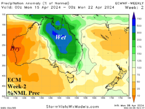
Discussion: Dramatic upper air setup for next week with a titanic upper ridge south of Australia and a compensating deep trough over New Zealand. A weak trough remains over Central Australia igniting more wet weather for the eastern half of the continent with cooler than normal conditions for west-central/north areas.
Week-3 Ahead Forecast valid April 21-27, 2024: Wet upper trough weakens.
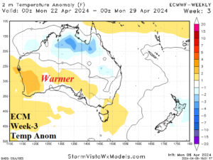
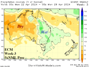
Discussion: The upper trough weakens and wet weather signature across East Australia is less robust while warming generates across southern areas. Northern areas could be warmer than indicated.
Week-4 Ahead Forecast valid April 28-May 4, 2024: Wetter East.
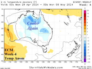
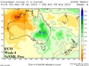
Discussion: Upper trough re-establishes over the southeast corner of the continent and wet conditions in the East continue.