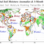
November 2025 Global Soil Moisture Outlook: Southern U.S. drought to evolve, Brazil dryness shifts into Argentina.
11/12/2025, 3:43 pm EST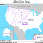
Snowy Last Week of November Northwest/North-central U.S.
11/16/2025, 12:19 pm EST
Climate Impact Company Early AG Market ALERT
Issued: Thursday November 13, 2025
Highlight: Pattern change is in the air for the Great Plains, Brazil, and Europe.
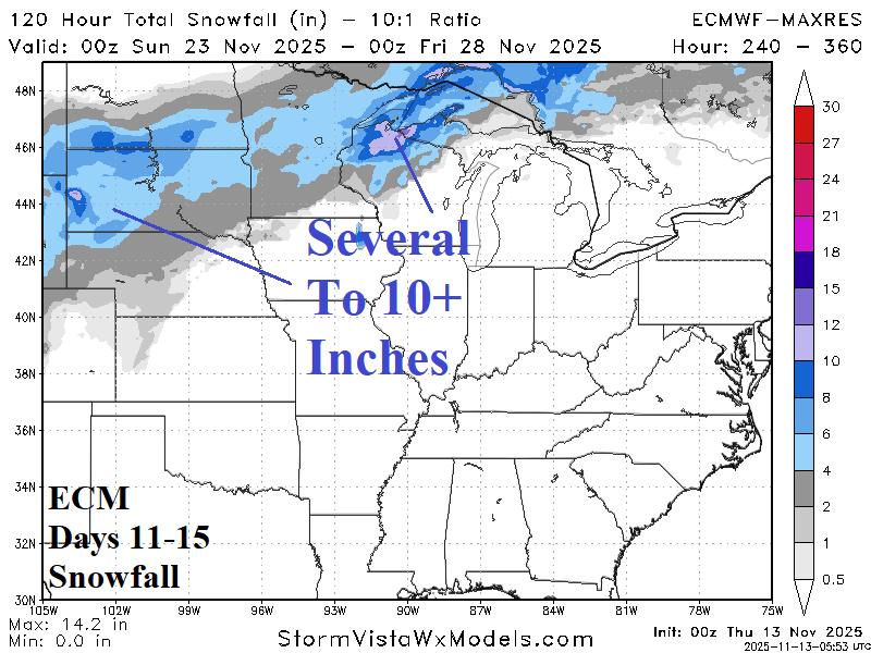

Fig. 1-2: The 11-15-day snowfall forecast for the North-central U.S. and the cold upper trough that follows according to ECM in 16-20 days.
Discussion: Snow cover governs cold weather potential as meteorological winter 2025-26 approaches. The West U.S. is the new target for storminess and building snow cover through the next 10 days. The stormy pattern extends to the Central U.S. after 10 days with the northern fringe unloading substantial snow for the Dakotas and Upper Midwest (Fig. 1). Once snow is on the ground, a cold weather making upper trough evolves across the North-central U.S. likely to linger well into December (Fig. 2).
The Climate Impact Company constructed analog climate forecast projects an early-to-middle meteorological summer 2025-26 upper trough on the Southeast Coast of Brazil. A pattern change is required to produce this pattern. The ECM, AI Graph Cast, AI 4CastNet V2 ECM ENS, and CFS V2 each indicate the Southeast Brazil Coastal upper trough developing in the 16-30-day period (Fig. 3-6). The sensible weather produced by the upper trough is wetter than normal for Central and East Brazil with dryness and anomalous heat to the south affecting Argentina to Southeast Brazil. The forecast represents a significant change from persistence which has favored dryness in Brazil and wet climate in Argentina.
Snow cover is below normal in Europe and the West-central portion of Canada (Fig. 7). However, an intense negative phase of the Scandinavia Index (-SCAND) identifies a persistent chilly snow-making upper trough setting up during the next 15 days over Northwest Eurasia (Fig. 8). Expect snow cover to evolve across Northern Europe causing a colder weather pattern to evolve.
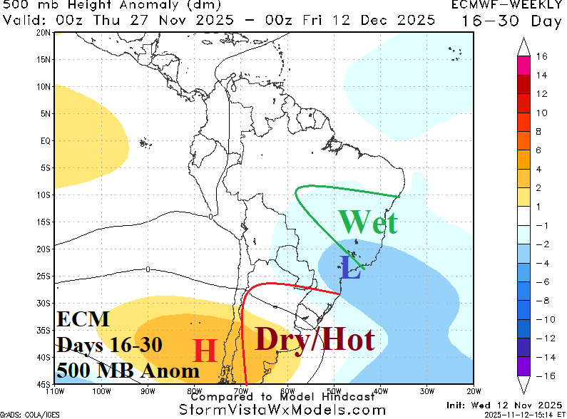


Fig. 3-6: ECM, Graph Cast, AI 4Cast Net V2 ECM ENS, and CFS V2 500 MB anomaly forecast for days 16-30 identifying the Southeast Brazil trough.

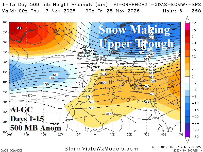
Fig. 7-8: The current northern hemisphere snow cover and 500 MB anomaly 15-day Graph Cast cold trough causing increasing snow cover across Northern Europe.