News
04/07/2024, 9:45 am EDT

Cloud Cover Forecast for April 8 Eclipse Update

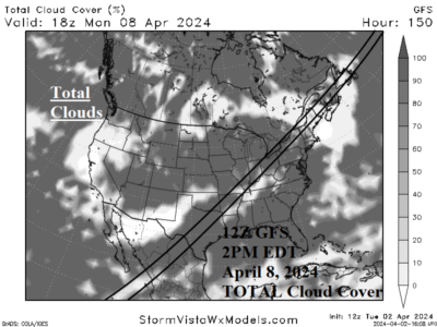
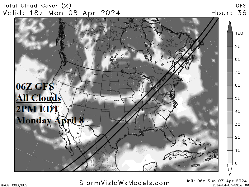
The cloud cover forecast using the most recent GFS forecast for the April 8 solar eclipse is updated. Texas and western New York have the poorest viewing. Best viewing continues across northern New England. The Ohio Valley viewing forecast is improving.
04/04/2024, 2:06 pm EDT

Could Buoyant Hurricane Forecasts Be Revised Higher Later This Spring?

The Colorado State University North Atlantic basin tropical cyclone season activity forecast reveals a dangerous projection featuring an accumulated cyclone energy index (ACE) of 210, sixth highest since 1950. The outlook projects 23 tropical storms, 11 hurricanes, and 5 major hurricanes. The outlook is slightly more active that last week’s Climate Impact Company forecast, and the initial forecast issued last December by Tropical Storm Risk/U.K. (their update is issued on April 8).
04/03/2024, 5:33 am EDT

The Record Rains for Northern Australia in March

The Australia Bureau of Meteorology stated that record rainfall was observed across Northern Australia during March 2024. The extreme rainfall pattern extends into Western Australia. Q1/2024 reflects a similar anomaly particularly the wet extreme across northern areas.
04/02/2024, 1:39 pm EDT

Latest Cloud Cover Forecast for the April 8th Eclipse

The 12Z GFS projects an area of showers stretching from the Texas Coast to Louisiana and northeastward to the central Appalachians and westward across the entire Ohio Valley next Monday afternoon around 2PM EDT. Low clouds (cumulus/nimbostratus) associated with rain are shifting east of the eclipse track from Texas to Arkansas but hang tough across the Ohio Valley. This type of cloud will be most opaque and cause a sharp weakened view of the eclipse.