News
01/07/2024, 9:43 am EST

Many U.S. Weather Hazards Ahead (Extreme Cold, Blizzards, and Flooding Rain)

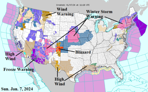
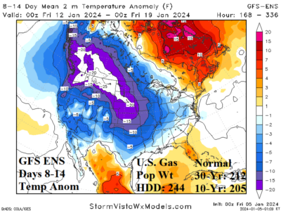
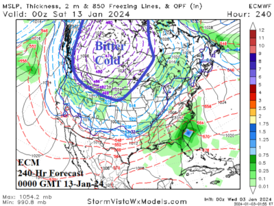
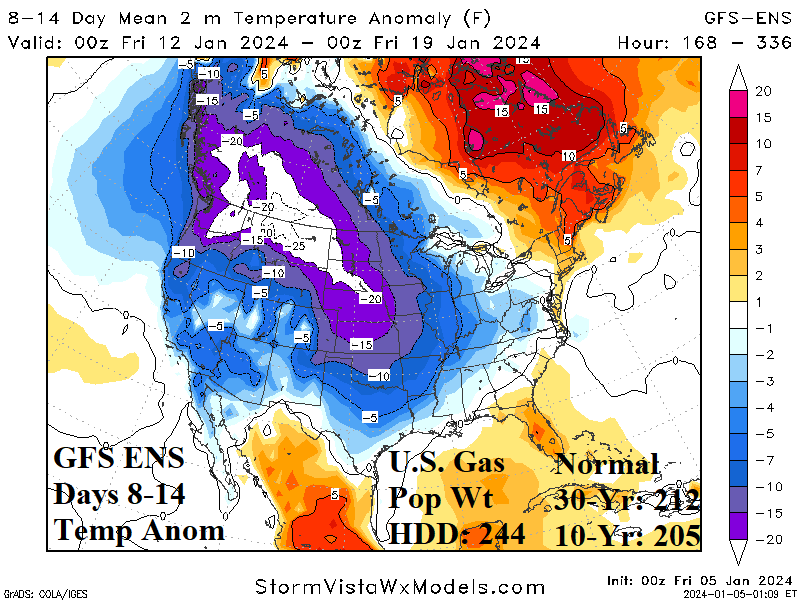
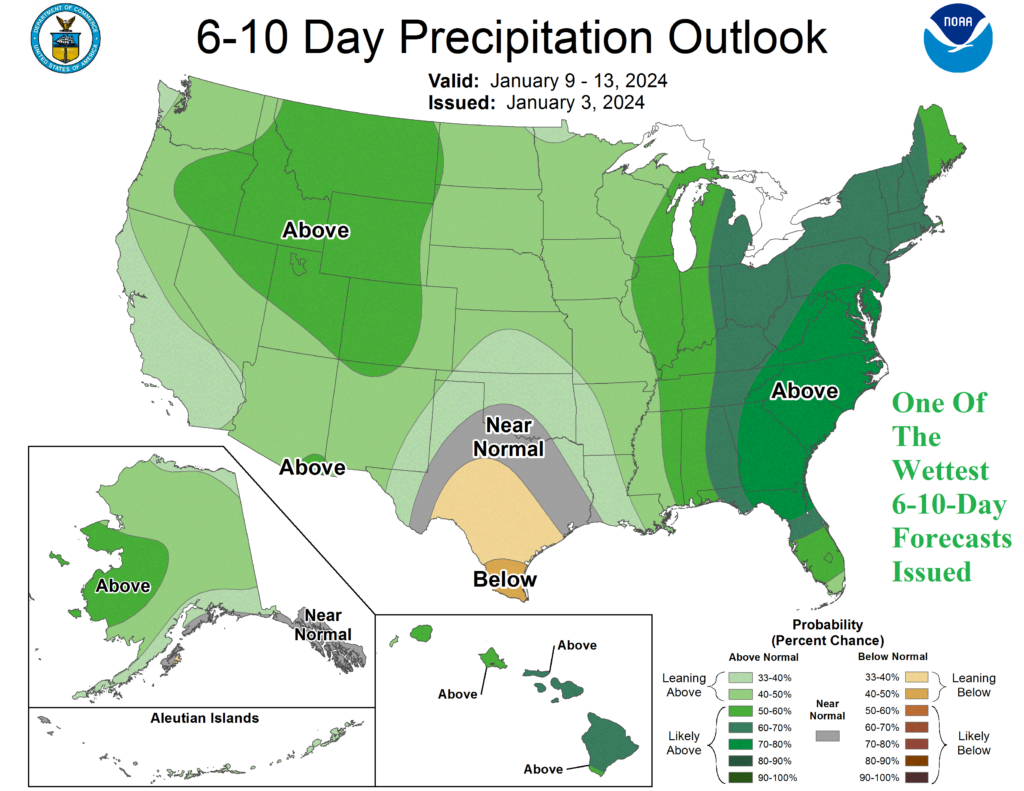
Using Graph Cast AI for the U.S. 10-day forecast reveals a colder look for the Great Plains to Texas while the East avoids the cold but has potent storms. The bitter cold strikes the Great Plains enhanced by snow cover. Arctic air reaches Texas although moderating south of snow cover. Several very low pressure El Nino storms lam the eastern part of the U.S. into mid-January.
01/05/2024, 9:04 am EST

Comparing The Mid-January 2024 Cold With Epic “Uri”

The ongoing SW episode has already spawned historic cold from Northwest Russia to Scandinavia and is forecast to expand and intensify through middle January. Unlike the first arctic air outbreak, the ongoing event will eventually feature an upper-level high pressure “ridge bridge” over Alaska to Siberia by later next week enabling a cross-polar flow of arctic air from the Eurasia source region into North America helping to intensify the North-central Canada polar vortex and the attendant longwave low-pressure trough into the U.S.
01/04/2024, 4:41 am EST

Highest Precipitation Probability for Days 6-10 Issued by NOAA/CPC in Memory

Yesterday's NOAA/CPC precipitation probability forecast for the East U.S. is the wettest in memory. Interestingly, Graph Cast AI emphasizes heavy to extreme rain (and wind) in the East during the 6-10-day timeframe while GFS and especially ECM are focused on incoming frigid arctic air in the West. Wild weather ahead in the U.S.
01/03/2024, 5:14 am EST

Warning…ECM Indicates Bitter Cold in 10 Days!

The overnight ECM 240-hour forecast is an attention getter. Frigid arctic air is present across the western half of Canada charging into the Northwest and North-central U.S. Temperatures average 20F to 40F below normal in this air mass and feature 2-meter temperature forecasts of -40F to -50F in Central Canada with below zero into Wyoming and South Dakota.